
WDD Wield Dalam, Malta - Earthquake Result Viewer
| ||||||||||||||||||
| ||||||||||||||||||
| ||||||||||||||||||
|
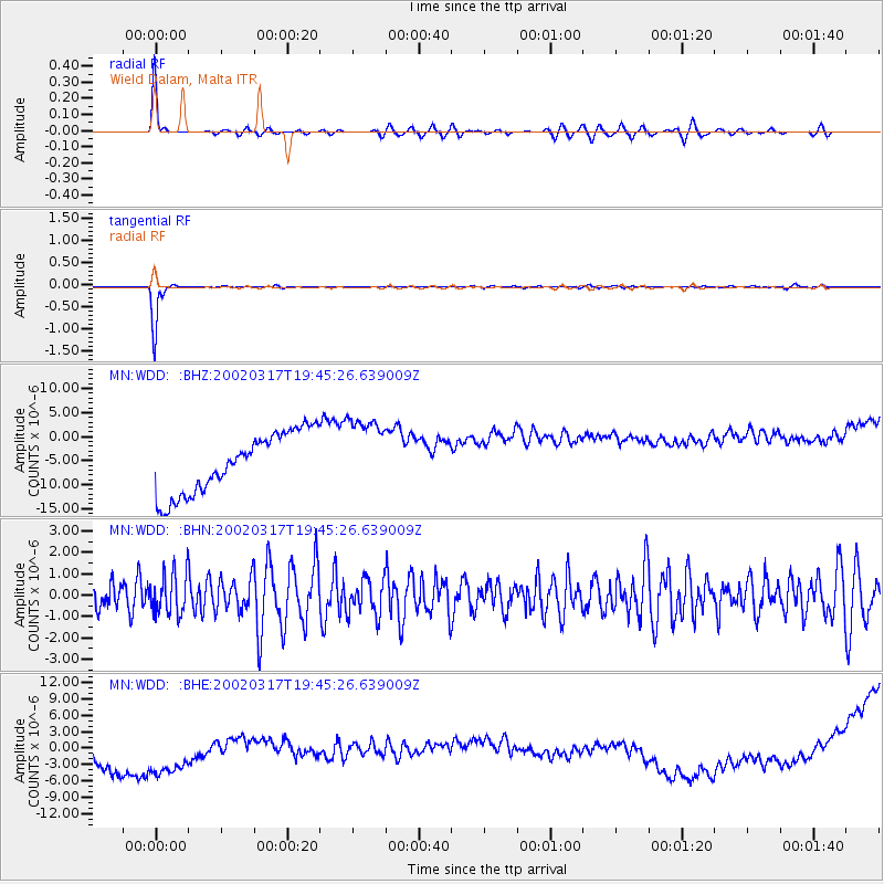
Signal To Noise
| Channel | StoN | STA | LTA |
| MN:WDD: :BHN:20020317T19:45:26.639009Z | 1.1518296 | 9.755474E-7 | 8.4695466E-7 |
| MN:WDD: :BHE:20020317T19:45:26.639009Z | 1.2515785 | 1.09522225E-5 | 8.750728E-6 |
| MN:WDD: :BHZ:20020317T19:45:26.639009Z | 1.2596366 | 7.905833E-6 | 6.27628E-6 |
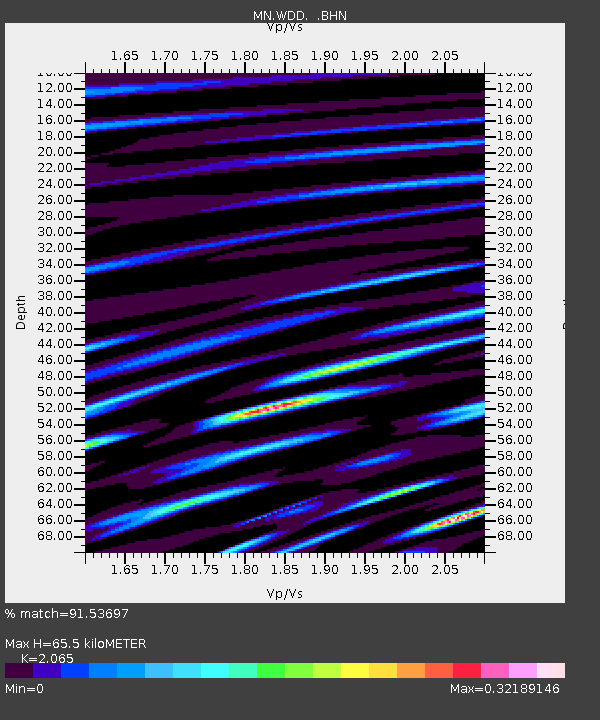
| Arrivals | |
| Ps | 17 SECOND |
| PpPs | 49 SECOND |
| PsPs/PpSs | 67 SECOND |

