You are here: Home > Network List > TS - TERRAscope (Southern California Seismic Network) Stations List
> Station PFO Pinon Flat, California, USA > Earthquake Result Viewer
PFO Pinon Flat, California, USA - Earthquake Result Viewer
*The percent match for this event was below the threshold and hence no stack was calculated.
| Earthquake location: |
Colombia |
| Earthquake latitude/longitude: |
4.6/-76.5 |
| Earthquake time(UTC): |
1997/02/19 (050) 18:25:12 GMT |
| Earthquake Depth: |
101 km |
| Earthquake Magnitude: |
5.5 MB, 5.8 UNKNOWN, 5.7 MW |
| Earthquake Catalog/Contributor: |
WHDF/NEIC |
|
| Network: |
TS TERRAscope (Southern California Seismic Network) |
| Station: |
PFO Pinon Flat, California, USA |
| Lat/Lon: |
33.61 N/116.46 W |
| Elevation: |
1280 m |
|
| Distance: |
47.1 deg |
| Az: |
312.933 deg |
| Baz: |
119.007 deg |
| Ray Param: |
$rayparam |
*The percent match for this event was below the threshold and hence was not used in the summary stack. |
|
| Radial Match: |
55.26516 % |
| Radial Bump: |
400 |
| Transverse Match: |
61.158543 % |
| Transverse Bump: |
390 |
| SOD ConfigId: |
4480 |
| Insert Time: |
2010-02-26 14:43:15.704 +0000 |
| GWidth: |
2.5 |
| Max Bumps: |
400 |
| Tol: |
0.001 |
|
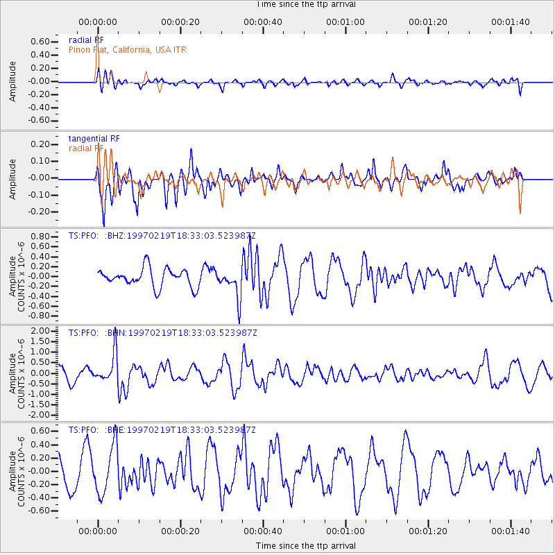
Signal To Noise
| Channel | StoN | STA | LTA |
| TS:PFO: :BHN:19970219T18:33:03.523987Z | 1.7755817 | 7.372184E-7 | 4.151982E-7 |
| TS:PFO: :BHE:19970219T18:33:03.523987Z | 1.9259034 | 3.7074471E-7 | 1.9250432E-7 |
| TS:PFO: :BHZ:19970219T18:33:03.523987Z | 1.644626 | 3.0135203E-7 | 1.8323438E-7 |
| Arrivals |
| Ps | |
| PpPs | |
| PsPs/PpSs | |


