You are here: Home > Network List > IW - Intermountain West Stations List
> Station MOOW Moose Ponds, Wyoming, USA > Earthquake Result Viewer
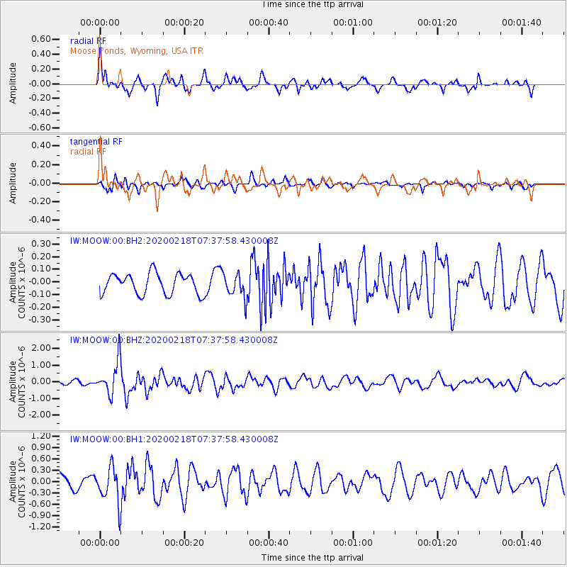
MOOW Moose Ponds, Wyoming, USA - Earthquake Result Viewer
*The percent match for this event was below the threshold and hence no stack was calculated.
| Earthquake location: |
North Of Svalbard |
| Earthquake latitude/longitude: |
85.7/22.7 |
| Earthquake time(UTC): |
2020/02/18 (049) 07:29:39 GMT |
| Earthquake Depth: |
10 km |
| Earthquake Magnitude: |
5.2 Mww |
| Earthquake Catalog/Contributor: |
NEIC PDE/us |
|
| Network: |
IW Intermountain West |
| Station: |
MOOW Moose Ponds, Wyoming, USA |
| Lat/Lon: |
43.75 N/110.74 W |
| Elevation: |
2128 m |
|
| Distance: |
49.5 deg |
| Az: |
316.189 deg |
| Baz: |
4.097 deg |
| Ray Param: |
$rayparam |
*The percent match for this event was below the threshold and hence was not used in the summary stack. |
|
| Radial Match: |
71.68734 % |
| Radial Bump: |
400 |
| Transverse Match: |
58.446285 % |
| Transverse Bump: |
400 |
| SOD ConfigId: |
20831131 |
| Insert Time: |
2020-03-15 21:37:53.612 +0000 |
| GWidth: |
2.5 |
| Max Bumps: |
400 |
| Tol: |
0.001 |
|
Signal To Noise
| Channel | StoN | STA | LTA |
| IW:MOOW:00:BHZ:20200218T07:37:58.430008Z | 9.526046 | 1.0236324E-6 | 1.07456174E-7 |
| IW:MOOW:00:BH1:20200218T07:37:58.430008Z | 2.5235715 | 4.864455E-7 | 1.9276074E-7 |
| IW:MOOW:00:BH2:20200218T07:37:58.430008Z | 1.1878277 | 9.654552E-8 | 8.127907E-8 |
| Arrivals |
| Ps | |
| PpPs | |
| PsPs/PpSs | |


