WDD Wield Dalam, Malta - Earthquake Result Viewer
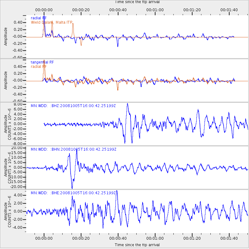
Earthquake location: Tajikistan-Xinjiang Border Reg.
Earthquake latitude/longitude: 39.5/73.8
Earthquake time(UTC): 2008/10/05 (279) 15:52:49 GMT
Earthquake Depth: 27 km
Earthquake Magnitude: 6.4 MB, 6.9 MS, 6.6 MW, 6.6 MW
Earthquake Catalog/Contributor: WHDF/NEIC
Network: MN MEDNET Project
Station: WDD Wield Dalam, Malta
Lat/Lon: 35.87 N/14.52 E
Elevation: 41 m
Distance: 46.3 deg
Az: 285.083 deg
Baz: 66.827 deg
Ray Param: 0.07066428
Estimated Moho Depth: 17.75 km
Estimated Crust Vp/Vs: 1.98
Assumed Crust Vp: 4.05 km/s
Estimated Crust Vs: 2.043 km/s
Estimated Crust Poisson's Ratio: 0.33
Radial Match: 92.468704 %
Radial Bump: 400
Transverse Match: 79.077995 %
Transverse Bump: 400
SOD ConfigId: 2556
Insert Time: 2010-03-08 18:03:07.898 +0000
GWidth: 2.5
Max Bumps: 400
Tol: 0.001

Signal To Noise

ChannelStoNSTALTA
MN:WDD: :BHN:20081005T16:00:42.25199Z3.1592068.674314E-72.745726E-7
MN:WDD: :BHE:20081005T16:00:42.25199Z1.21964543.8008716E-73.1163742E-7
MN:WDD: :BHZ:20081005T16:00:42.25199Z2.01871285.207346E-72.5795381E-7
Arrivals
Ps4.4 SECOND
PpPs13 SECOND
PsPs/PpSs17 SECOND