
WDD Wield Dalam, Malta - Earthquake Result Viewer
| ||||||||||||||||||
| ||||||||||||||||||
| ||||||||||||||||||
|
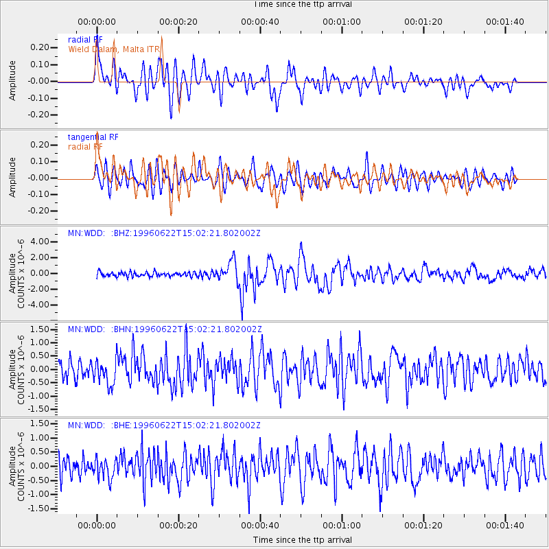
Signal To Noise
| Channel | StoN | STA | LTA |
| MN:WDD: :BHN:19960622T15:02:21.802002Z | 1.5175042 | 4.6556488E-7 | 3.0679644E-7 |
| MN:WDD: :BHE:19960622T15:02:21.802002Z | 1.0664494 | 3.502298E-7 | 3.284073E-7 |
| MN:WDD: :BHZ:19960622T15:02:21.802002Z | 4.941373 | 1.3315521E-6 | 2.6947006E-7 |
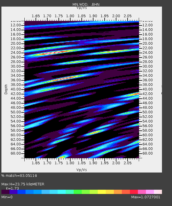
| Arrivals | |
| Ps | 4.3 SECOND |
| PpPs | 16 SECOND |
| PsPs/PpSs | 20 SECOND |

