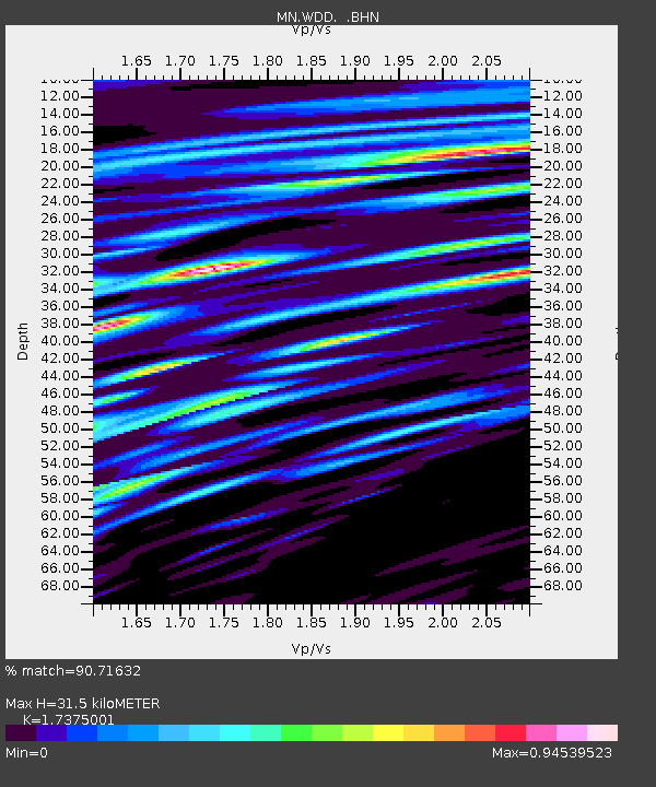
WDD Wield Dalam, Malta - Earthquake Result Viewer
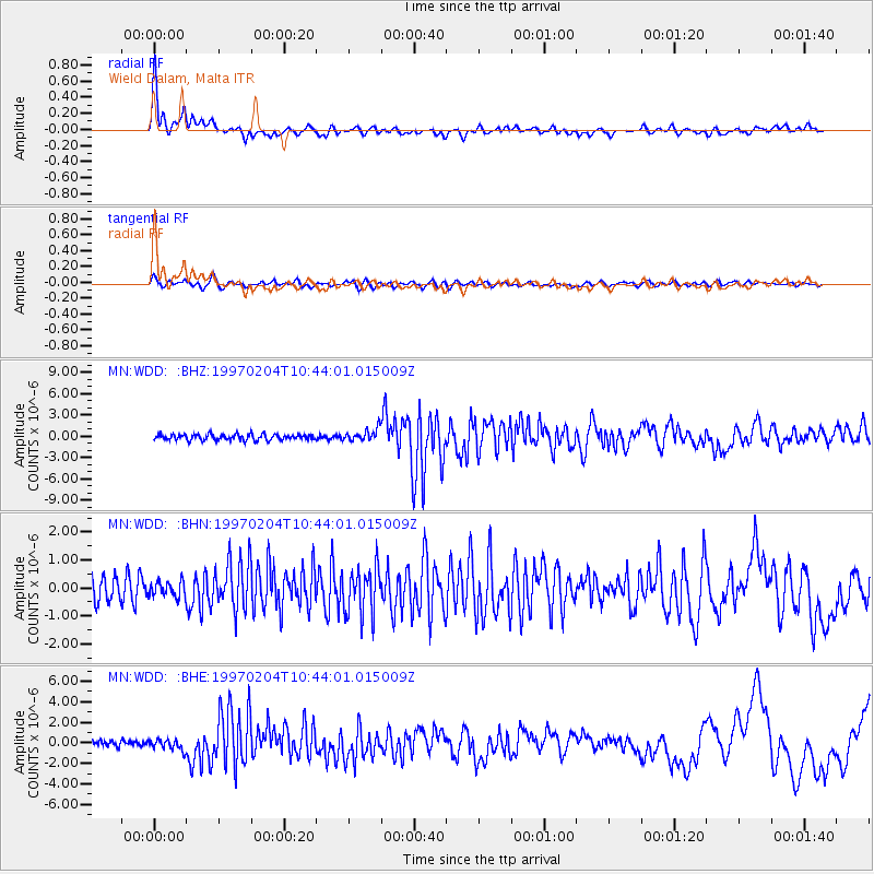
Earthquake location: Turkmenistan-Iran Border Region
Earthquake latitude/longitude: 37.7/57.3
Earthquake time(UTC): 1997/02/04 (035) 10:37:47 GMT
Earthquake Depth: 10 km
Earthquake Magnitude: 5.9 MB, 6.8 MS, 6.5 UNKNOWN, 6.4 MW
Earthquake Catalog/Contributor: WHDF/NEIC
Network: MN MEDNET Project
Station: WDD Wield Dalam, Malta
Lat/Lon: 35.87 N/14.52 E
Elevation: 41 m
Distance: 34.1 deg
Az: 280.292 deg
Baz: 74.019 deg
Ray Param: 0.07790534
Estimated Moho Depth: 31.5 km
Estimated Crust Vp/Vs: 1.74
Assumed Crust Vp: 4.05 km/s
Estimated Crust Vs: 2.331 km/s
Estimated Crust Poisson's Ratio: 0.25
Radial Match: 90.71632 %
Radial Bump: 400
Transverse Match: 67.650635 %
Transverse Bump: 400
SOD ConfigId: 6273
Insert Time: 2010-03-08 18:03:32.201 +0000
GWidth: 2.5
Max Bumps: 400
Tol: 0.001

Signal To Noise

ChannelStoNSTALTA
MN:WDD: :BHN:19970204T10:44:01.015009Z0.8741442.744562E-73.1397136E-7
MN:WDD: :BHE:19970204T10:44:01.015009Z1.72817815.302717E-73.0683853E-7
MN:WDD: :BHZ:19970204T10:44:01.015009Z2.0885028.5053324E-74.072456E-7
Arrivals
Ps5.9 SECOND
PpPs21 SECOND
PsPs/PpSs27 SECOND