
WDD Wield Dalam, Malta - Earthquake Result Viewer
| ||||||||||||||||||
| ||||||||||||||||||
| ||||||||||||||||||
|
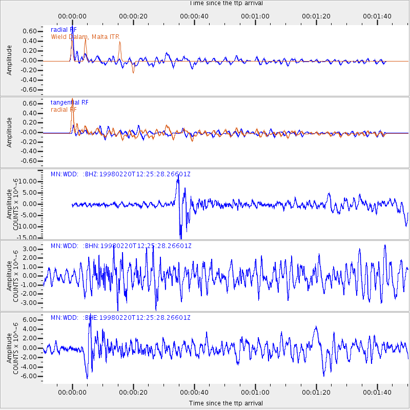
Signal To Noise
| Channel | StoN | STA | LTA |
| MN:WDD: :BHN:19980220T12:25:28.26601Z | 1.4274822 | 9.64163E-7 | 6.75429E-7 |
| MN:WDD: :BHE:19980220T12:25:28.26601Z | 3.6284537 | 1.8308151E-6 | 5.045717E-7 |
| MN:WDD: :BHZ:19980220T12:25:28.26601Z | 8.027198 | 4.0862715E-6 | 5.090533E-7 |
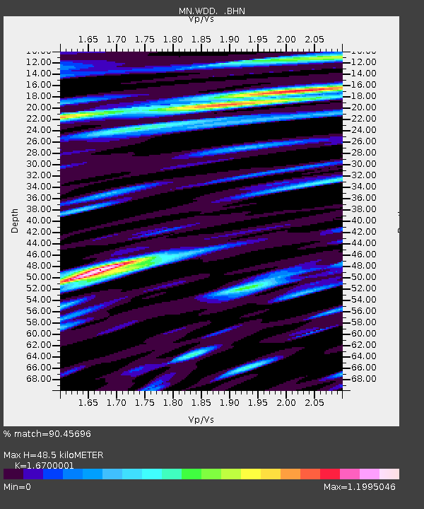
| Arrivals | |
| Ps | 8.2 SECOND |
| PpPs | 31 SECOND |
| PsPs/PpSs | 39 SECOND |

