You are here: Home > Network List > NE - New England Seismic Network Stations List
> Station EMMW Machias, ME, USA > Earthquake Result Viewer
EMMW Machias, ME, USA - Earthquake Result Viewer
*The percent match for this event was below the threshold and hence no stack was calculated.
| Earthquake location: |
North Of Svalbard |
| Earthquake latitude/longitude: |
85.7/22.7 |
| Earthquake time(UTC): |
2020/02/18 (049) 07:29:39 GMT |
| Earthquake Depth: |
10 km |
| Earthquake Magnitude: |
5.2 Mww |
| Earthquake Catalog/Contributor: |
NEIC PDE/us |
|
| Network: |
NE New England Seismic Network |
| Station: |
EMMW Machias, ME, USA |
| Lat/Lon: |
44.71 N/67.46 W |
| Elevation: |
35 m |
|
| Distance: |
45.7 deg |
| Az: |
274.361 deg |
| Baz: |
6.002 deg |
| Ray Param: |
$rayparam |
*The percent match for this event was below the threshold and hence was not used in the summary stack. |
|
| Radial Match: |
62.502716 % |
| Radial Bump: |
394 |
| Transverse Match: |
62.020767 % |
| Transverse Bump: |
381 |
| SOD ConfigId: |
20831131 |
| Insert Time: |
2020-03-15 22:26:30.736 +0000 |
| GWidth: |
2.5 |
| Max Bumps: |
400 |
| Tol: |
0.001 |
|
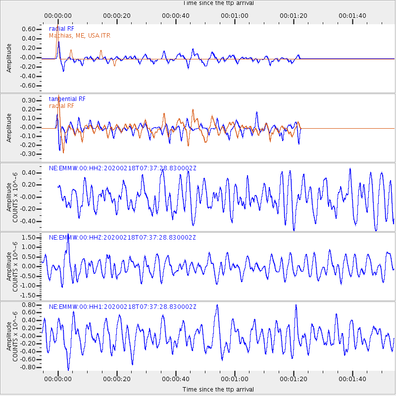
Signal To Noise
| Channel | StoN | STA | LTA |
| NE:EMMW:00:HHZ:20200218T07:37:28.830002Z | 2.1644049 | 6.999456E-7 | 3.233894E-7 |
| NE:EMMW:00:HH1:20200218T07:37:28.830002Z | 2.109931 | 3.8634298E-7 | 1.8310692E-7 |
| NE:EMMW:00:HH2:20200218T07:37:28.830002Z | 1.2453264 | 1.8339907E-7 | 1.4726987E-7 |
| Arrivals |
| Ps | |
| PpPs | |
| PsPs/PpSs | |


