You are here: Home > Network List > MN - MEDNET Project Stations List
> Station WDD Wield Dalam, Malta > Earthquake Result Viewer
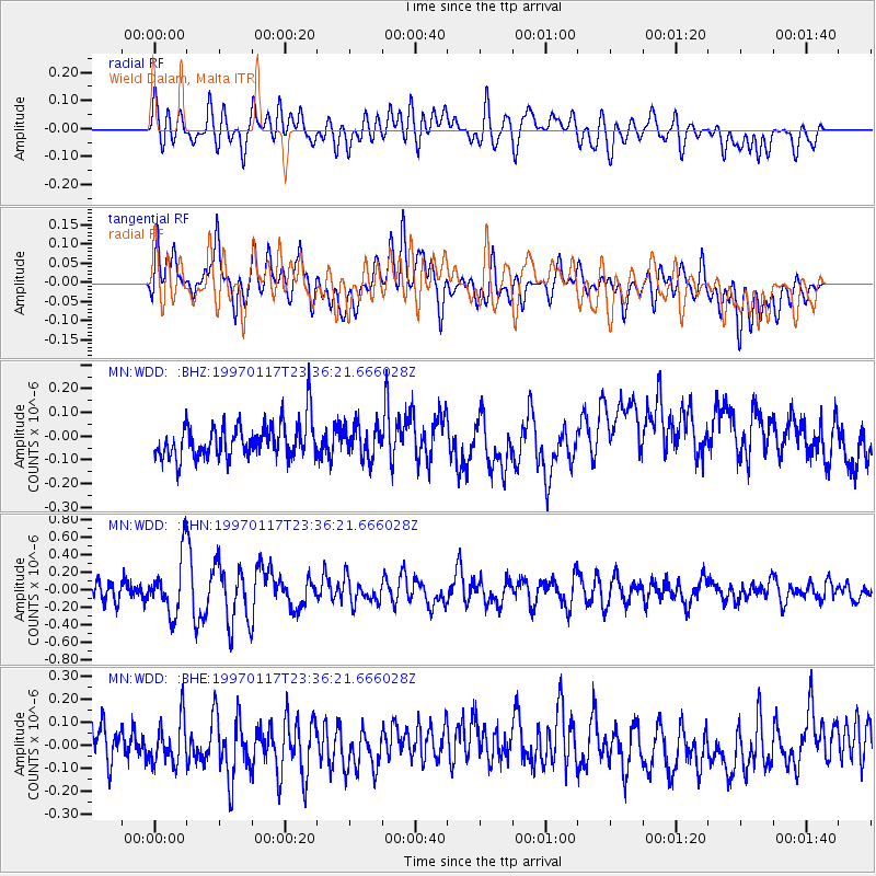
WDD Wield Dalam, Malta - Earthquake Result Viewer
*The percent match for this event was below the threshold and hence no stack was calculated.
| Earthquake location: |
Southern Mid-Atlantic Ridge |
| Earthquake latitude/longitude: |
-47.4/-13.5 |
| Earthquake time(UTC): |
1997/01/17 (017) 23:24:09 GMT |
| Earthquake Depth: |
10 km |
| Earthquake Magnitude: |
5.7 MS, 5.4 MB, 5.8 UNKNOWN, 5.6 MW |
| Earthquake Catalog/Contributor: |
WHDF/NEIC |
|
| Network: |
MN MEDNET Project |
| Station: |
WDD Wield Dalam, Malta |
| Lat/Lon: |
35.87 N/14.52 E |
| Elevation: |
41 m |
|
| Distance: |
86.6 deg |
| Az: |
22.437 deg |
| Baz: |
198.61 deg |
| Ray Param: |
$rayparam |
*The percent match for this event was below the threshold and hence was not used in the summary stack. |
|
| Radial Match: |
45.70138 % |
| Radial Bump: |
400 |
| Transverse Match: |
43.91971 % |
| Transverse Bump: |
400 |
| SOD ConfigId: |
4480 |
| Insert Time: |
2010-03-08 18:04:13.006 +0000 |
| GWidth: |
2.5 |
| Max Bumps: |
400 |
| Tol: |
0.001 |
|
Signal To Noise
| Channel | StoN | STA | LTA |
| MN:WDD: :BHN:19970117T23:36:21.666028Z | 4.0353622 | 3.3003238E-7 | 8.178507E-8 |
| MN:WDD: :BHE:19970117T23:36:21.666028Z | 1.1341218 | 9.821637E-8 | 8.660125E-8 |
| MN:WDD: :BHZ:19970117T23:36:21.666028Z | 0.8904957 | 6.586464E-8 | 7.396402E-8 |
| Arrivals |
| Ps | |
| PpPs | |
| PsPs/PpSs | |


