You are here: Home > Network List > TA - USArray Transportable Network (new EarthScope stations) Stations List
> Station L15K Ungalak Mountain, AK, USA > Earthquake Result Viewer
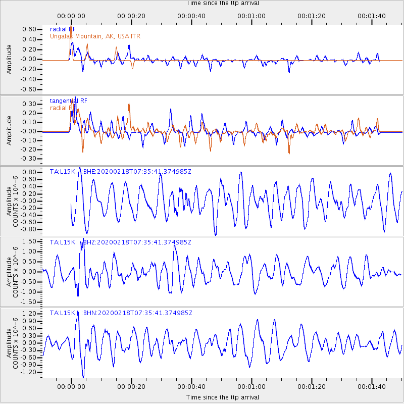
L15K Ungalak Mountain, AK, USA - Earthquake Result Viewer
*The percent match for this event was below the threshold and hence no stack was calculated.
| Earthquake location: |
North Of Svalbard |
| Earthquake latitude/longitude: |
85.7/22.7 |
| Earthquake time(UTC): |
2020/02/18 (049) 07:29:39 GMT |
| Earthquake Depth: |
10 km |
| Earthquake Magnitude: |
5.2 Mww |
| Earthquake Catalog/Contributor: |
NEIC PDE/us |
|
| Network: |
TA USArray Transportable Network (new EarthScope stations) |
| Station: |
L15K Ungalak Mountain, AK, USA |
| Lat/Lon: |
61.68 N/161.49 W |
| Elevation: |
219 m |
|
| Distance: |
32.8 deg |
| Az: |
3.689 deg |
| Baz: |
359.422 deg |
| Ray Param: |
$rayparam |
*The percent match for this event was below the threshold and hence was not used in the summary stack. |
|
| Radial Match: |
62.700745 % |
| Radial Bump: |
394 |
| Transverse Match: |
57.82416 % |
| Transverse Bump: |
261 |
| SOD ConfigId: |
20831131 |
| Insert Time: |
2020-03-15 23:44:43.969 +0000 |
| GWidth: |
2.5 |
| Max Bumps: |
400 |
| Tol: |
0.001 |
|
Signal To Noise
| Channel | StoN | STA | LTA |
| TA:L15K: :BHZ:20200218T07:35:41.374985Z | 1.615435 | 8.394039E-7 | 5.196148E-7 |
| TA:L15K: :BHN:20200218T07:35:41.374985Z | 2.255167 | 7.666228E-7 | 3.3994058E-7 |
| TA:L15K: :BHE:20200218T07:35:41.374985Z | 0.92638785 | 4.0283953E-7 | 4.3484977E-7 |
| Arrivals |
| Ps | |
| PpPs | |
| PsPs/PpSs | |


