You are here: Home > Network List > TS - TERRAscope (Southern California Seismic Network) Stations List
> Station PFO Pinon Flat, California, USA > Earthquake Result Viewer
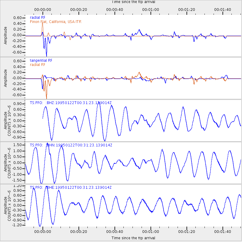
PFO Pinon Flat, California, USA - Earthquake Result Viewer
*The percent match for this event was below the threshold and hence no stack was calculated.
| Earthquake location: |
Fiji Islands Region |
| Earthquake latitude/longitude: |
-20.4/-178.0 |
| Earthquake time(UTC): |
1995/01/22 (022) 00:20:40 GMT |
| Earthquake Depth: |
504 km |
| Earthquake Magnitude: |
5.1 MB, 5.7 UNKNOWN, 5.7 MW |
| Earthquake Catalog/Contributor: |
WHDF/NEIC |
|
| Network: |
TS TERRAscope (Southern California Seismic Network) |
| Station: |
PFO Pinon Flat, California, USA |
| Lat/Lon: |
33.61 N/116.46 W |
| Elevation: |
1280 m |
|
| Distance: |
79.5 deg |
| Az: |
48.263 deg |
| Baz: |
237.014 deg |
| Ray Param: |
$rayparam |
*The percent match for this event was below the threshold and hence was not used in the summary stack. |
|
| Radial Match: |
86.89145 % |
| Radial Bump: |
400 |
| Transverse Match: |
68.013374 % |
| Transverse Bump: |
400 |
| SOD ConfigId: |
4480 |
| Insert Time: |
2010-02-26 14:43:21.380 +0000 |
| GWidth: |
2.5 |
| Max Bumps: |
400 |
| Tol: |
0.001 |
|
Signal To Noise
| Channel | StoN | STA | LTA |
| TS:PFO: :BHN:19950122T00:31:23.139014Z | 2.5633762 | 1.2362743E-6 | 4.822836E-7 |
| TS:PFO: :BHE:19950122T00:31:23.139014Z | 2.3144846 | 7.6962357E-7 | 3.3252482E-7 |
| TS:PFO: :BHZ:19950122T00:31:23.139014Z | 1.6803609 | 7.40635E-7 | 4.4075946E-7 |
| Arrivals |
| Ps | |
| PpPs | |
| PsPs/PpSs | |


