You are here: Home > Network List > GS - US Geological Survey Networks Stations List
> Station DEC05 Decatur Surface Seismic Site, Decatur, IL, USA > Earthquake Result Viewer
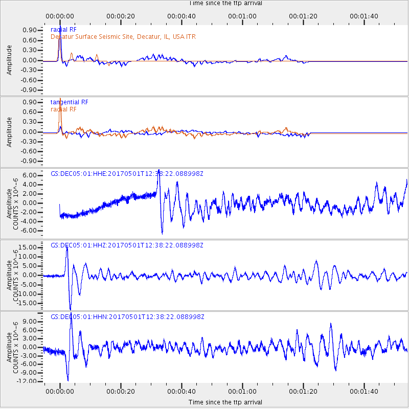
DEC05 Decatur Surface Seismic Site, Decatur, IL, USA - Earthquake Result Viewer
*The percent match for this event was below the threshold and hence no stack was calculated.
| Earthquake location: |
Southeastern Alaska |
| Earthquake latitude/longitude: |
59.9/-136.6 |
| Earthquake time(UTC): |
2017/05/01 (121) 12:31:53 GMT |
| Earthquake Depth: |
0.1 km |
| Earthquake Magnitude: |
6.5 Ml |
| Earthquake Catalog/Contributor: |
NEIC PDE/ak |
|
| Network: |
GS US Geological Survey Networks |
| Station: |
DEC05 Decatur Surface Seismic Site, Decatur, IL, USA |
| Lat/Lon: |
39.87 N/88.87 W |
| Elevation: |
216 m |
|
| Distance: |
35.6 deg |
| Az: |
102.393 deg |
| Baz: |
320.186 deg |
| Ray Param: |
$rayparam |
*The percent match for this event was below the threshold and hence was not used in the summary stack. |
|
| Radial Match: |
66.97696 % |
| Radial Bump: |
400 |
| Transverse Match: |
22.799934 % |
| Transverse Bump: |
400 |
| SOD ConfigId: |
2028011 |
| Insert Time: |
2017-05-15 12:36:05.127 +0000 |
| GWidth: |
2.5 |
| Max Bumps: |
400 |
| Tol: |
0.001 |
|
Signal To Noise
| Channel | StoN | STA | LTA |
| GS:DEC05:01:HHZ:20170501T12:38:22.088998Z | 33.16972 | 7.884738E-6 | 2.3770892E-7 |
| GS:DEC05:01:HHN:20170501T12:38:22.088998Z | 7.155185 | 5.5881633E-6 | 7.809949E-7 |
| GS:DEC05:01:HHE:20170501T12:38:22.088998Z | 2.5899453 | 3.9616916E-6 | 1.5296429E-6 |
| Arrivals |
| Ps | |
| PpPs | |
| PsPs/PpSs | |


