You are here: Home > Network List > TA - USArray Transportable Network (new EarthScope stations) Stations List
> Station R33M Jennings River, BC, CAN > Earthquake Result Viewer
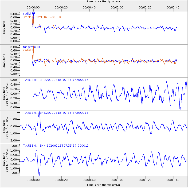
R33M Jennings River, BC, CAN - Earthquake Result Viewer
*The percent match for this event was below the threshold and hence no stack was calculated.
| Earthquake location: |
North Of Svalbard |
| Earthquake latitude/longitude: |
85.7/22.7 |
| Earthquake time(UTC): |
2020/02/18 (049) 07:29:39 GMT |
| Earthquake Depth: |
10 km |
| Earthquake Magnitude: |
5.2 Mww |
| Earthquake Catalog/Contributor: |
NEIC PDE/us |
|
| Network: |
TA USArray Transportable Network (new EarthScope stations) |
| Station: |
R33M Jennings River, BC, CAN |
| Lat/Lon: |
59.39 N/130.97 W |
| Elevation: |
1437 m |
|
| Distance: |
34.7 deg |
| Az: |
336.482 deg |
| Baz: |
3.344 deg |
| Ray Param: |
$rayparam |
*The percent match for this event was below the threshold and hence was not used in the summary stack. |
|
| Radial Match: |
70.625275 % |
| Radial Bump: |
375 |
| Transverse Match: |
68.73521 % |
| Transverse Bump: |
400 |
| SOD ConfigId: |
20831131 |
| Insert Time: |
2020-03-15 23:49:22.559 +0000 |
| GWidth: |
2.5 |
| Max Bumps: |
400 |
| Tol: |
0.001 |
|
Signal To Noise
| Channel | StoN | STA | LTA |
| TA:R33M: :BHZ:20200218T07:35:57.90001Z | 6.1832247 | 9.990666E-7 | 1.6157695E-7 |
| TA:R33M: :BHN:20200218T07:35:57.90001Z | 4.644025 | 8.299392E-7 | 1.787112E-7 |
| TA:R33M: :BHE:20200218T07:35:57.90001Z | 0.89030457 | 1.1563192E-7 | 1.2987906E-7 |
| Arrivals |
| Ps | |
| PpPs | |
| PsPs/PpSs | |


