You are here: Home > Network List > GS - US Geological Survey Networks Stations List
> Station KAN09 East Station, Caldwell, KS, USA > Earthquake Result Viewer
KAN09 East Station, Caldwell, KS, USA - Earthquake Result Viewer
*The percent match for this event was below the threshold and hence no stack was calculated.
| Earthquake location: |
Southeastern Alaska |
| Earthquake latitude/longitude: |
59.9/-136.6 |
| Earthquake time(UTC): |
2017/05/01 (121) 12:31:53 GMT |
| Earthquake Depth: |
0.1 km |
| Earthquake Magnitude: |
6.5 Ml |
| Earthquake Catalog/Contributor: |
NEIC PDE/ak |
|
| Network: |
GS US Geological Survey Networks |
| Station: |
KAN09 East Station, Caldwell, KS, USA |
| Lat/Lon: |
37.14 N/97.62 W |
| Elevation: |
371 m |
|
| Distance: |
33.6 deg |
| Az: |
114.915 deg |
| Baz: |
325.069 deg |
| Ray Param: |
$rayparam |
*The percent match for this event was below the threshold and hence was not used in the summary stack. |
|
| Radial Match: |
42.441357 % |
| Radial Bump: |
400 |
| Transverse Match: |
42.14883 % |
| Transverse Bump: |
400 |
| SOD ConfigId: |
2028011 |
| Insert Time: |
2017-05-15 12:36:31.028 +0000 |
| GWidth: |
2.5 |
| Max Bumps: |
400 |
| Tol: |
0.001 |
|
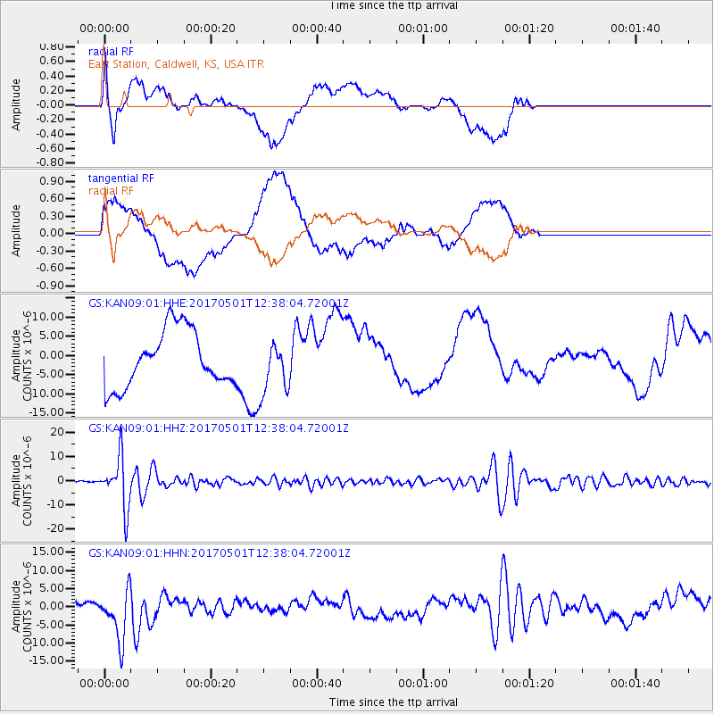
Signal To Noise
| Channel | StoN | STA | LTA |
| GS:KAN09:01:HHZ:20170501T12:38:04.72001Z | 17.887392 | 1.060397E-5 | 5.928181E-7 |
| GS:KAN09:01:HHN:20170501T12:38:04.72001Z | 2.4831686 | 7.092428E-6 | 2.8562006E-6 |
| GS:KAN09:01:HHE:20170501T12:38:04.72001Z | 0.9544971 | 6.952012E-6 | 7.283429E-6 |
| Arrivals |
| Ps | |
| PpPs | |
| PsPs/PpSs | |


