You are here: Home > Network List > GS - US Geological Survey Networks Stations List
> Station KAN13 Rinehart Farm > Earthquake Result Viewer
KAN13 Rinehart Farm - Earthquake Result Viewer
*The percent match for this event was below the threshold and hence no stack was calculated.
| Earthquake location: |
Southeastern Alaska |
| Earthquake latitude/longitude: |
59.9/-136.6 |
| Earthquake time(UTC): |
2017/05/01 (121) 12:31:53 GMT |
| Earthquake Depth: |
0.1 km |
| Earthquake Magnitude: |
6.5 Ml |
| Earthquake Catalog/Contributor: |
NEIC PDE/ak |
|
| Network: |
GS US Geological Survey Networks |
| Station: |
KAN13 Rinehart Farm |
| Lat/Lon: |
37.01 N/97.48 W |
| Elevation: |
340 m |
|
| Distance: |
33.8 deg |
| Az: |
114.876 deg |
| Baz: |
325.121 deg |
| Ray Param: |
$rayparam |
*The percent match for this event was below the threshold and hence was not used in the summary stack. |
|
| Radial Match: |
30.894234 % |
| Radial Bump: |
400 |
| Transverse Match: |
8.306213 % |
| Transverse Bump: |
400 |
| SOD ConfigId: |
2028011 |
| Insert Time: |
2017-05-15 12:36:36.665 +0000 |
| GWidth: |
2.5 |
| Max Bumps: |
400 |
| Tol: |
0.001 |
|
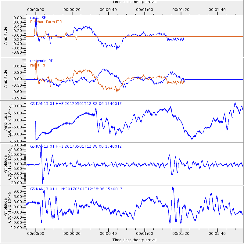
Signal To Noise
| Channel | StoN | STA | LTA |
| GS:KAN13:01:HHZ:20170501T12:38:06.154001Z | 43.35947 | 9.380446E-6 | 2.1634132E-7 |
| GS:KAN13:01:HHN:20170501T12:38:06.154001Z | 4.3863416 | 5.0181497E-6 | 1.1440399E-6 |
| GS:KAN13:01:HHE:20170501T12:38:06.154001Z | 2.0693924 | 9.113919E-6 | 4.404152E-6 |
| Arrivals |
| Ps | |
| PpPs | |
| PsPs/PpSs | |


