You are here: Home > Network List > US - United States National Seismic Network Stations List
> Station GLMI Grayling, Michigan, USA > Earthquake Result Viewer
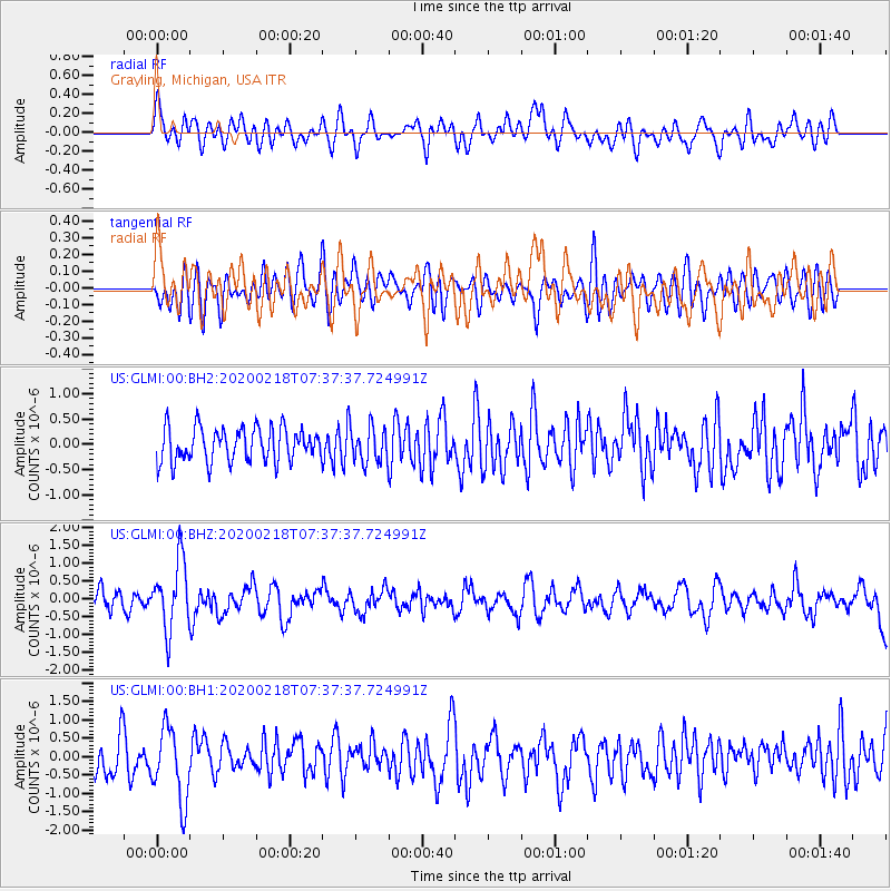
GLMI Grayling, Michigan, USA - Earthquake Result Viewer
*The percent match for this event was below the threshold and hence no stack was calculated.
| Earthquake location: |
North Of Svalbard |
| Earthquake latitude/longitude: |
85.7/22.7 |
| Earthquake time(UTC): |
2020/02/18 (049) 07:29:39 GMT |
| Earthquake Depth: |
10 km |
| Earthquake Magnitude: |
5.2 Mww |
| Earthquake Catalog/Contributor: |
NEIC PDE/us |
|
| Network: |
US United States National Seismic Network |
| Station: |
GLMI Grayling, Michigan, USA |
| Lat/Lon: |
44.82 N/84.62 W |
| Elevation: |
387 m |
|
| Distance: |
46.8 deg |
| Az: |
291.219 deg |
| Baz: |
5.622 deg |
| Ray Param: |
$rayparam |
*The percent match for this event was below the threshold and hence was not used in the summary stack. |
|
| Radial Match: |
61.03443 % |
| Radial Bump: |
400 |
| Transverse Match: |
43.636253 % |
| Transverse Bump: |
400 |
| SOD ConfigId: |
20831131 |
| Insert Time: |
2020-03-16 00:11:31.371 +0000 |
| GWidth: |
2.5 |
| Max Bumps: |
400 |
| Tol: |
0.001 |
|
Signal To Noise
| Channel | StoN | STA | LTA |
| US:GLMI:00:BHZ:20200218T07:37:37.724991Z | 3.7941184 | 9.505482E-7 | 2.5053203E-7 |
| US:GLMI:00:BH1:20200218T07:37:37.724991Z | 2.5158541 | 9.954214E-7 | 3.956594E-7 |
| US:GLMI:00:BH2:20200218T07:37:37.724991Z | 1.0902674 | 3.6360865E-7 | 3.335041E-7 |
| Arrivals |
| Ps | |
| PpPs | |
| PsPs/PpSs | |


