You are here: Home > Network List > US - United States National Seismic Network Stations List
> Station HAWA Hanford, Washington, USA > Earthquake Result Viewer
HAWA Hanford, Washington, USA - Earthquake Result Viewer
*The percent match for this event was below the threshold and hence no stack was calculated.
| Earthquake location: |
North Of Svalbard |
| Earthquake latitude/longitude: |
85.7/22.7 |
| Earthquake time(UTC): |
2020/02/18 (049) 07:29:39 GMT |
| Earthquake Depth: |
10 km |
| Earthquake Magnitude: |
5.2 Mww |
| Earthquake Catalog/Contributor: |
NEIC PDE/us |
|
| Network: |
US United States National Seismic Network |
| Station: |
HAWA Hanford, Washington, USA |
| Lat/Lon: |
46.39 N/119.53 W |
| Elevation: |
364 m |
|
| Distance: |
47.2 deg |
| Az: |
324.739 deg |
| Baz: |
3.576 deg |
| Ray Param: |
$rayparam |
*The percent match for this event was below the threshold and hence was not used in the summary stack. |
|
| Radial Match: |
68.035355 % |
| Radial Bump: |
378 |
| Transverse Match: |
52.140114 % |
| Transverse Bump: |
400 |
| SOD ConfigId: |
20831131 |
| Insert Time: |
2020-03-16 00:11:42.371 +0000 |
| GWidth: |
2.5 |
| Max Bumps: |
400 |
| Tol: |
0.001 |
|
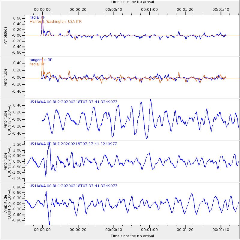
Signal To Noise
| Channel | StoN | STA | LTA |
| US:HAWA:00:BHZ:20200218T07:37:41.324997Z | 3.8250945 | 8.3941E-7 | 2.1944817E-7 |
| US:HAWA:00:BH1:20200218T07:37:41.324997Z | 2.8780687 | 4.5635724E-7 | 1.5856371E-7 |
| US:HAWA:00:BH2:20200218T07:37:41.324997Z | 1.2061994 | 1.945394E-7 | 1.6128294E-7 |
| Arrivals |
| Ps | |
| PpPs | |
| PsPs/PpSs | |


