You are here: Home > Network List > US - United States National Seismic Network Stations List
> Station LAO LASA Array, Montana, USA > Earthquake Result Viewer
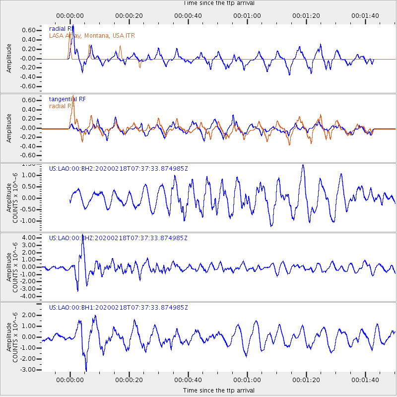
LAO LASA Array, Montana, USA - Earthquake Result Viewer
*The percent match for this event was below the threshold and hence no stack was calculated.
| Earthquake location: |
North Of Svalbard |
| Earthquake latitude/longitude: |
85.7/22.7 |
| Earthquake time(UTC): |
2020/02/18 (049) 07:29:39 GMT |
| Earthquake Depth: |
10 km |
| Earthquake Magnitude: |
5.2 Mww |
| Earthquake Catalog/Contributor: |
NEIC PDE/us |
|
| Network: |
US United States National Seismic Network |
| Station: |
LAO LASA Array, Montana, USA |
| Lat/Lon: |
46.69 N/106.22 W |
| Elevation: |
902 m |
|
| Distance: |
46.3 deg |
| Az: |
312.194 deg |
| Baz: |
4.616 deg |
| Ray Param: |
$rayparam |
*The percent match for this event was below the threshold and hence was not used in the summary stack. |
|
| Radial Match: |
64.98284 % |
| Radial Bump: |
377 |
| Transverse Match: |
57.364002 % |
| Transverse Bump: |
400 |
| SOD ConfigId: |
20831131 |
| Insert Time: |
2020-03-16 00:12:35.522 +0000 |
| GWidth: |
2.5 |
| Max Bumps: |
400 |
| Tol: |
0.001 |
|
Signal To Noise
| Channel | StoN | STA | LTA |
| US:LAO:00:BHZ:20200218T07:37:33.874985Z | 10.236147 | 1.8070748E-6 | 1.7653858E-7 |
| US:LAO:00:BH1:20200218T07:37:33.874985Z | 1.3888445 | 9.120297E-7 | 6.5668235E-7 |
| US:LAO:00:BH2:20200218T07:37:33.874985Z | 1.7084423 | 4.4324312E-7 | 2.5944286E-7 |
| Arrivals |
| Ps | |
| PpPs | |
| PsPs/PpSs | |


