You are here: Home > Network List > US - United States National Seismic Network Stations List
> Station WMOK Wichita Mountains, Oklahoma, USA > Earthquake Result Viewer
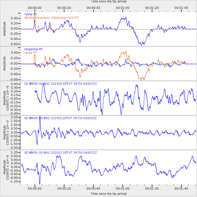
WMOK Wichita Mountains, Oklahoma, USA - Earthquake Result Viewer
*The percent match for this event was below the threshold and hence no stack was calculated.
| Earthquake location: |
North Of Svalbard |
| Earthquake latitude/longitude: |
85.7/22.7 |
| Earthquake time(UTC): |
2020/02/18 (049) 07:29:39 GMT |
| Earthquake Depth: |
10 km |
| Earthquake Magnitude: |
5.2 Mww |
| Earthquake Catalog/Contributor: |
NEIC PDE/us |
|
| Network: |
US United States National Seismic Network |
| Station: |
WMOK Wichita Mountains, Oklahoma, USA |
| Lat/Lon: |
34.74 N/98.78 W |
| Elevation: |
486 m |
|
| Distance: |
57.8 deg |
| Az: |
303.862 deg |
| Baz: |
4.324 deg |
| Ray Param: |
$rayparam |
*The percent match for this event was below the threshold and hence was not used in the summary stack. |
|
| Radial Match: |
26.793669 % |
| Radial Bump: |
400 |
| Transverse Match: |
50.678432 % |
| Transverse Bump: |
400 |
| SOD ConfigId: |
20831131 |
| Insert Time: |
2020-03-16 00:14:39.716 +0000 |
| GWidth: |
2.5 |
| Max Bumps: |
400 |
| Tol: |
0.001 |
|
Signal To Noise
| Channel | StoN | STA | LTA |
| US:WMOK:00:BHZ:20200218T07:38:59.099015Z | 5.209169 | 8.320597E-7 | 1.5972982E-7 |
| US:WMOK:00:BH1:20200218T07:38:59.099015Z | 2.1897724 | 6.5776334E-7 | 3.0037978E-7 |
| US:WMOK:00:BH2:20200218T07:38:59.099015Z | 1.7050297 | 2.2267236E-7 | 1.3059736E-7 |
| Arrivals |
| Ps | |
| PpPs | |
| PsPs/PpSs | |


