You are here: Home > Network List > TS - TERRAscope (Southern California Seismic Network) Stations List
> Station PFO Pinon Flat, California, USA > Earthquake Result Viewer
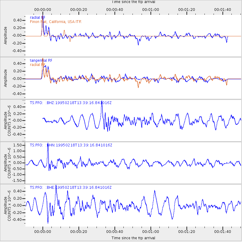
PFO Pinon Flat, California, USA - Earthquake Result Viewer
*The percent match for this event was below the threshold and hence no stack was calculated.
| Earthquake location: |
Sea Of Okhotsk |
| Earthquake latitude/longitude: |
46.7/145.9 |
| Earthquake time(UTC): |
1995/02/18 (049) 13:29:06 GMT |
| Earthquake Depth: |
355 km |
| Earthquake Magnitude: |
5.6 MB, 5.7 UNKNOWN, 5.5 MW |
| Earthquake Catalog/Contributor: |
WHDF/NEIC |
|
| Network: |
TS TERRAscope (Southern California Seismic Network) |
| Station: |
PFO Pinon Flat, California, USA |
| Lat/Lon: |
33.61 N/116.46 W |
| Elevation: |
1280 m |
|
| Distance: |
71.2 deg |
| Az: |
60.92 deg |
| Baz: |
313.847 deg |
| Ray Param: |
$rayparam |
*The percent match for this event was below the threshold and hence was not used in the summary stack. |
|
| Radial Match: |
46.50776 % |
| Radial Bump: |
394 |
| Transverse Match: |
60.096004 % |
| Transverse Bump: |
400 |
| SOD ConfigId: |
4480 |
| Insert Time: |
2010-02-26 14:43:22.994 +0000 |
| GWidth: |
2.5 |
| Max Bumps: |
400 |
| Tol: |
0.001 |
|
Signal To Noise
| Channel | StoN | STA | LTA |
| TS:PFO: :BHN:19950218T13:39:16.841016Z | 4.2948537 | 5.1856205E-7 | 1.2074034E-7 |
| TS:PFO: :BHE:19950218T13:39:16.841016Z | 2.4509845 | 2.4247717E-7 | 9.893052E-8 |
| TS:PFO: :BHZ:19950218T13:39:16.841016Z | 2.5839307 | 2.2999474E-7 | 8.900964E-8 |
| Arrivals |
| Ps | |
| PpPs | |
| PsPs/PpSs | |


