You are here: Home > Network List > TS - TERRAscope (Southern California Seismic Network) Stations List
> Station PFO Pinon Flat, California, USA > Earthquake Result Viewer
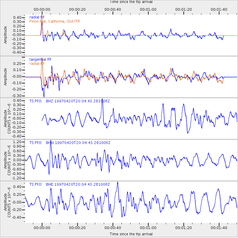
PFO Pinon Flat, California, USA - Earthquake Result Viewer
*The percent match for this event was below the threshold and hence no stack was calculated.
| Earthquake location: |
Chile-Argentina Border Region |
| Earthquake latitude/longitude: |
-34.0/-70.0 |
| Earthquake time(UTC): |
1997/04/20 (110) 19:53:15 GMT |
| Earthquake Depth: |
105 km |
| Earthquake Magnitude: |
5.6 UNKNOWN, 5.3 MB, 5.5 MD |
| Earthquake Catalog/Contributor: |
WHDF/NEIC |
|
| Network: |
TS TERRAscope (Southern California Seismic Network) |
| Station: |
PFO Pinon Flat, California, USA |
| Lat/Lon: |
33.61 N/116.46 W |
| Elevation: |
1280 m |
|
| Distance: |
80.2 deg |
| Az: |
322.118 deg |
| Baz: |
142.34 deg |
| Ray Param: |
$rayparam |
*The percent match for this event was below the threshold and hence was not used in the summary stack. |
|
| Radial Match: |
63.043076 % |
| Radial Bump: |
400 |
| Transverse Match: |
69.3632 % |
| Transverse Bump: |
400 |
| SOD ConfigId: |
4480 |
| Insert Time: |
2010-02-26 14:43:24.233 +0000 |
| GWidth: |
2.5 |
| Max Bumps: |
400 |
| Tol: |
0.001 |
|
Signal To Noise
| Channel | StoN | STA | LTA |
| TS:PFO: :BHN:19970420T20:04:43.281006Z | 2.6869283 | 4.2159022E-7 | 1.5690416E-7 |
| TS:PFO: :BHE:19970420T20:04:43.281006Z | 1.0701134 | 1.3325837E-7 | 1.2452733E-7 |
| TS:PFO: :BHZ:19970420T20:04:43.281006Z | 2.0392797 | 1.6538897E-7 | 8.110167E-8 |
| Arrivals |
| Ps | |
| PpPs | |
| PsPs/PpSs | |


