HFEB Harrisburg Flat east 11 - Earthquake Result Viewer
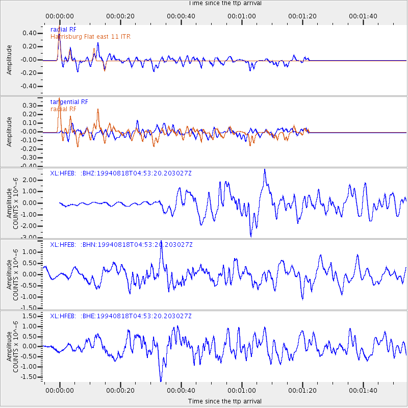
Earthquake location: East Of Kuril Islands
Earthquake latitude/longitude: 44.7/150.2
Earthquake time(UTC): 1994/08/18 (230) 04:42:59 GMT
Earthquake Depth: 33 km
Earthquake Magnitude: 6.1 MB, 6.5 MS, 6.6 UNKNOWN, 6.5 MW
Earthquake Catalog/Contributor: WHDF/NEIC
Network: XL Southern Seirra - Death Valley
Station: HFEB Harrisburg Flat east 11
Lat/Lon: 36.36 N/117.08 W
Elevation: 1650 m
Distance: 67.3 deg
Az: 60.925 deg
Baz: 309.419 deg
Ray Param: 0.05699721
Estimated Moho Depth: 26.75 km
Estimated Crust Vp/Vs: 1.80
Assumed Crust Vp: 6.279 km/s
Estimated Crust Vs: 3.493 km/s
Estimated Crust Poisson's Ratio: 0.28
Radial Match: 84.70309 %
Radial Bump: 349
Transverse Match: 63.021004 %
Transverse Bump: 400
SOD ConfigId: 17000
Insert Time: 2010-03-08 18:06:24.270 +0000
GWidth: 2.5
Max Bumps: 400
Tol: 0.001

Signal To Noise

ChannelStoNSTALTA
XL:HFEB: :BHN:19940818T04:53:20.203027Z0.66628641.3626882E-72.0451989E-7
XL:HFEB: :BHE:19940818T04:53:20.203027Z1.35724991.5943027E-71.17465675E-7
XL:HFEB: :BHZ:19940818T04:53:20.203027Z2.5609372.907326E-71.1352588E-7
Arrivals
Ps3.5 SECOND
PpPs11 SECOND
PsPs/PpSs15 SECOND