You are here: Home > Network List > TA - USArray Transportable Network (new EarthScope stations) Stations List
> Station H31M Peel River, Yukon, CAN > Earthquake Result Viewer
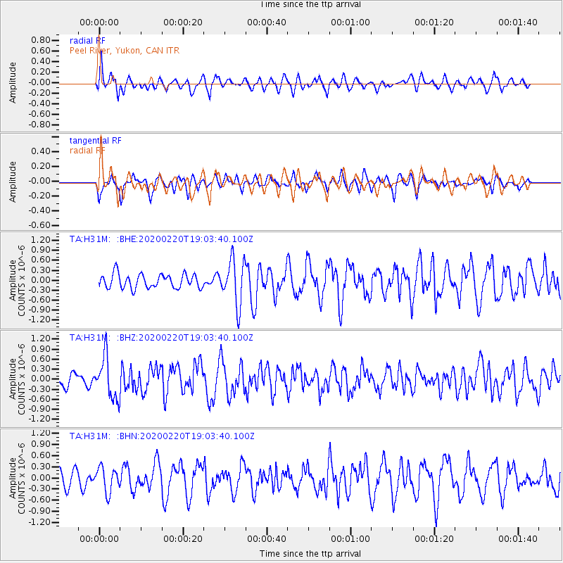
H31M Peel River, Yukon, CAN - Earthquake Result Viewer
*The percent match for this event was below the threshold and hence no stack was calculated.
| Earthquake location: |
Near East Coast Of Kamchatka |
| Earthquake latitude/longitude: |
53.6/160.8 |
| Earthquake time(UTC): |
2020/02/20 (051) 18:57:36 GMT |
| Earthquake Depth: |
34 km |
| Earthquake Magnitude: |
5.7 Mwb |
| Earthquake Catalog/Contributor: |
NEIC PDE/us |
|
| Network: |
TA USArray Transportable Network (new EarthScope stations) |
| Station: |
H31M Peel River, Yukon, CAN |
| Lat/Lon: |
65.81 N/134.34 W |
| Elevation: |
642 m |
|
| Distance: |
33.3 deg |
| Az: |
42.87 deg |
| Baz: |
280.589 deg |
| Ray Param: |
$rayparam |
*The percent match for this event was below the threshold and hence was not used in the summary stack. |
|
| Radial Match: |
50.556965 % |
| Radial Bump: |
400 |
| Transverse Match: |
54.95222 % |
| Transverse Bump: |
392 |
| SOD ConfigId: |
20831131 |
| Insert Time: |
2020-03-19 08:29:38.723 +0000 |
| GWidth: |
2.5 |
| Max Bumps: |
400 |
| Tol: |
0.001 |
|
Signal To Noise
| Channel | StoN | STA | LTA |
| TA:H31M: :BHZ:20200220T19:03:40.100Z | 2.5422301 | 6.3352303E-7 | 2.491997E-7 |
| TA:H31M: :BHN:20200220T19:03:40.100Z | 1.1114144 | 3.37256E-7 | 3.0344756E-7 |
| TA:H31M: :BHE:20200220T19:03:40.100Z | 3.3050478 | 6.918179E-7 | 2.0932161E-7 |
| Arrivals |
| Ps | |
| PpPs | |
| PsPs/PpSs | |


