You are here: Home > Network List > US - United States National Seismic Network Stations List
> Station EGMT Eagleton, Montana, USA > Earthquake Result Viewer
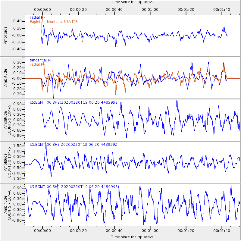
EGMT Eagleton, Montana, USA - Earthquake Result Viewer
*The percent match for this event was below the threshold and hence no stack was calculated.
| Earthquake location: |
Near East Coast Of Kamchatka |
| Earthquake latitude/longitude: |
53.6/160.8 |
| Earthquake time(UTC): |
2020/02/20 (051) 18:57:36 GMT |
| Earthquake Depth: |
34 km |
| Earthquake Magnitude: |
5.7 Mwb |
| Earthquake Catalog/Contributor: |
NEIC PDE/us |
|
| Network: |
US United States National Seismic Network |
| Station: |
EGMT Eagleton, Montana, USA |
| Lat/Lon: |
48.02 N/109.75 W |
| Elevation: |
1055 m |
|
| Distance: |
53.2 deg |
| Az: |
56.974 deg |
| Baz: |
311.951 deg |
| Ray Param: |
$rayparam |
*The percent match for this event was below the threshold and hence was not used in the summary stack. |
|
| Radial Match: |
48.66966 % |
| Radial Bump: |
361 |
| Transverse Match: |
48.028393 % |
| Transverse Bump: |
400 |
| SOD ConfigId: |
20831131 |
| Insert Time: |
2020-03-19 08:55:48.806 +0000 |
| GWidth: |
2.5 |
| Max Bumps: |
400 |
| Tol: |
0.001 |
|
Signal To Noise
| Channel | StoN | STA | LTA |
| US:EGMT:00:BHZ:20200220T19:06:20.448999Z | 4.0475454 | 7.538553E-7 | 1.8624999E-7 |
| US:EGMT:00:BH1:20200220T19:06:20.448999Z | 1.0255078 | 4.3100943E-7 | 4.2028879E-7 |
| US:EGMT:00:BH2:20200220T19:06:20.448999Z | 1.2700377 | 4.411404E-7 | 3.4734433E-7 |
| Arrivals |
| Ps | |
| PpPs | |
| PsPs/PpSs | |


