You are here: Home > Network List > UW - Pacific Northwest Regional Seismic Network Stations List
> Station IRON Crane, OR, USA > Earthquake Result Viewer
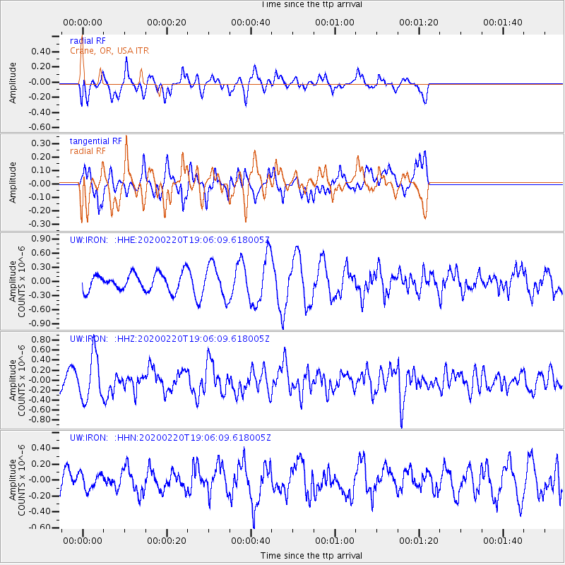
IRON Crane, OR, USA - Earthquake Result Viewer
*The percent match for this event was below the threshold and hence no stack was calculated.
| Earthquake location: |
Near East Coast Of Kamchatka |
| Earthquake latitude/longitude: |
53.6/160.8 |
| Earthquake time(UTC): |
2020/02/20 (051) 18:57:36 GMT |
| Earthquake Depth: |
34 km |
| Earthquake Magnitude: |
5.7 Mwb |
| Earthquake Catalog/Contributor: |
NEIC PDE/us |
|
| Network: |
UW Pacific Northwest Regional Seismic Network |
| Station: |
IRON Crane, OR, USA |
| Lat/Lon: |
43.36 N/118.47 W |
| Elevation: |
1226 m |
|
| Distance: |
51.7 deg |
| Az: |
66.49 deg |
| Baz: |
311.528 deg |
| Ray Param: |
$rayparam |
*The percent match for this event was below the threshold and hence was not used in the summary stack. |
|
| Radial Match: |
63.463673 % |
| Radial Bump: |
400 |
| Transverse Match: |
64.77943 % |
| Transverse Bump: |
400 |
| SOD ConfigId: |
20831131 |
| Insert Time: |
2020-03-19 09:05:15.869 +0000 |
| GWidth: |
2.5 |
| Max Bumps: |
400 |
| Tol: |
0.001 |
|
Signal To Noise
| Channel | StoN | STA | LTA |
| UW:IRON: :HHZ:20200220T19:06:09.618005Z | 2.6505702 | 4.551417E-7 | 1.7171463E-7 |
| UW:IRON: :HHN:20200220T19:06:09.618005Z | 0.6839913 | 1.085871E-7 | 1.5875509E-7 |
| UW:IRON: :HHE:20200220T19:06:09.618005Z | 1.9235165 | 3.507259E-7 | 1.823358E-7 |
| Arrivals |
| Ps | |
| PpPs | |
| PsPs/PpSs | |


