You are here: Home > Network List > CI - Caltech Regional Seismic Network Stations List
> Station MPM Manuel Prospect Mine, California, USA > Earthquake Result Viewer
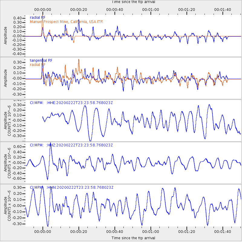
MPM Manuel Prospect Mine, California, USA - Earthquake Result Viewer
*The percent match for this event was below the threshold and hence no stack was calculated.
| Earthquake location: |
West Chile Rise |
| Earthquake latitude/longitude: |
-38.1/-93.7 |
| Earthquake time(UTC): |
2020/02/22 (053) 23:12:37 GMT |
| Earthquake Depth: |
10 km |
| Earthquake Magnitude: |
5.5 mww |
| Earthquake Catalog/Contributor: |
NEIC PDE/us |
|
| Network: |
CI Caltech Regional Seismic Network |
| Station: |
MPM Manuel Prospect Mine, California, USA |
| Lat/Lon: |
36.06 N/117.49 W |
| Elevation: |
185 m |
|
| Distance: |
77.0 deg |
| Az: |
340.431 deg |
| Baz: |
160.974 deg |
| Ray Param: |
$rayparam |
*The percent match for this event was below the threshold and hence was not used in the summary stack. |
|
| Radial Match: |
53.66345 % |
| Radial Bump: |
400 |
| Transverse Match: |
46.43396 % |
| Transverse Bump: |
400 |
| SOD ConfigId: |
20831131 |
| Insert Time: |
2020-03-20 07:22:54.365 +0000 |
| GWidth: |
2.5 |
| Max Bumps: |
400 |
| Tol: |
0.001 |
|
Signal To Noise
| Channel | StoN | STA | LTA |
| CI:MPM: :HHZ:20200222T23:23:58.768023Z | 5.009915 | 3.923664E-7 | 7.8317974E-8 |
| CI:MPM: :HHN:20200222T23:23:58.768023Z | 1.4651961 | 2.4591725E-7 | 1.6783913E-7 |
| CI:MPM: :HHE:20200222T23:23:58.768023Z | 2.1562283 | 2.4322586E-7 | 1.1280154E-7 |
| Arrivals |
| Ps | |
| PpPs | |
| PsPs/PpSs | |


