You are here: Home > Network List > US - United States National Seismic Network Stations List
> Station AAM Ann Arbor, Michigan, USA > Earthquake Result Viewer
AAM Ann Arbor, Michigan, USA - Earthquake Result Viewer

| Earthquake location: |
Southeastern Alaska |
| Earthquake latitude/longitude: |
59.9/-136.6 |
| Earthquake time(UTC): |
2017/05/01 (121) 12:31:53 GMT |
| Earthquake Depth: |
0.1 km |
| Earthquake Magnitude: |
6.5 Ml |
| Earthquake Catalog/Contributor: |
NEIC PDE/ak |
|
| Network: |
US United States National Seismic Network |
| Station: |
AAM Ann Arbor, Michigan, USA |
| Lat/Lon: |
42.30 N/83.66 W |
| Elevation: |
172 m |
|
| Distance: |
36.4 deg |
| Az: |
94.636 deg |
| Baz: |
317.322 deg |
| Ray Param: |
0.076714925 |
| Estimated Moho Depth: |
41.0 km |
| Estimated Crust Vp/Vs: |
1.90 |
| Assumed Crust Vp: |
6.483 km/s |
| Estimated Crust Vs: |
3.403 km/s |
| Estimated Crust Poisson's Ratio: |
0.31 |
|
| Radial Match: |
94.26552 % |
| Radial Bump: |
266 |
| Transverse Match: |
86.92255 % |
| Transverse Bump: |
400 |
| SOD ConfigId: |
2028011 |
| Insert Time: |
2017-05-15 12:43:33.998 +0000 |
| GWidth: |
2.5 |
| Max Bumps: |
400 |
| Tol: |
0.001 |
|
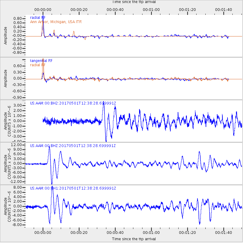
Signal To Noise
| Channel | StoN | STA | LTA |
| US:AAM:00:BHZ:20170501T12:38:28.699991Z | 23.89809 | 4.936543E-6 | 2.0656641E-7 |
| US:AAM:00:BH1:20170501T12:38:28.699991Z | 9.142327 | 2.8735315E-6 | 3.1431074E-7 |
| US:AAM:00:BH2:20170501T12:38:28.699991Z | 5.220839 | 1.5731695E-6 | 3.0132503E-7 |
| Arrivals |
| Ps | 6.1 SECOND |
| PpPs | 17 SECOND |
| PsPs/PpSs | 23 SECOND |


