You are here: Home > Network List > CN - Canadian National Seismograph Network Stations List
> Station INK INUVIK, NT > Earthquake Result Viewer
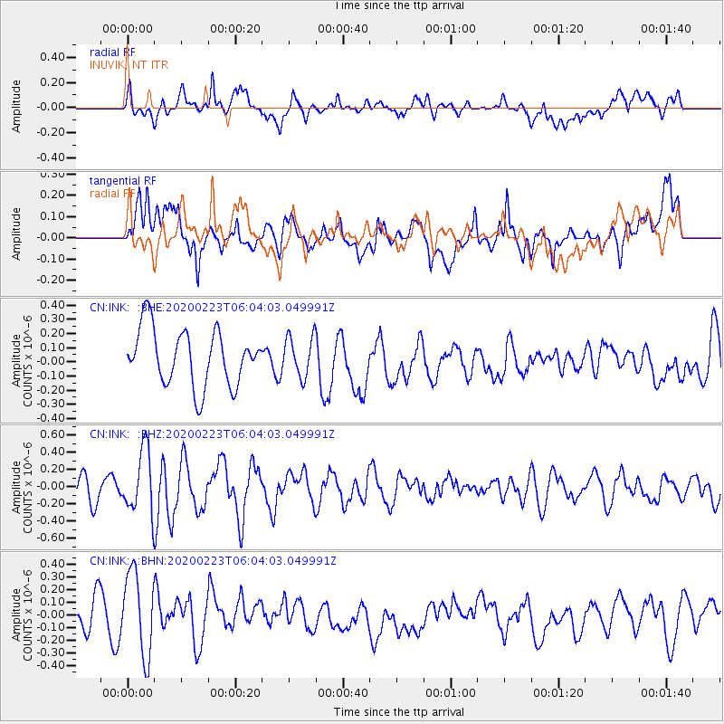
INK INUVIK, NT - Earthquake Result Viewer
*The percent match for this event was below the threshold and hence no stack was calculated.
| Earthquake location: |
Turkey-Iran Border Region |
| Earthquake latitude/longitude: |
38.5/44.4 |
| Earthquake time(UTC): |
2020/02/23 (054) 05:53:01 GMT |
| Earthquake Depth: |
6.4 km |
| Earthquake Magnitude: |
5.7 mww |
| Earthquake Catalog/Contributor: |
NEIC PDE/us |
|
| Network: |
CN Canadian National Seismograph Network |
| Station: |
INK INUVIK, NT |
| Lat/Lon: |
68.31 N/133.53 W |
| Elevation: |
44 m |
|
| Distance: |
73.5 deg |
| Az: |
359.197 deg |
| Baz: |
1.694 deg |
| Ray Param: |
$rayparam |
*The percent match for this event was below the threshold and hence was not used in the summary stack. |
|
| Radial Match: |
50.064972 % |
| Radial Bump: |
400 |
| Transverse Match: |
55.785107 % |
| Transverse Bump: |
400 |
| SOD ConfigId: |
20831131 |
| Insert Time: |
2020-03-22 01:53:58.423 +0000 |
| GWidth: |
2.5 |
| Max Bumps: |
400 |
| Tol: |
0.001 |
|
Signal To Noise
| Channel | StoN | STA | LTA |
| CN:INK: :BHZ:20200223T06:04:03.049991Z | 1.9265614 | 3.7234938E-7 | 1.9327149E-7 |
| CN:INK: :BHN:20200223T06:04:03.049991Z | 2.2812827 | 3.366772E-7 | 1.4758241E-7 |
| CN:INK: :BHE:20200223T06:04:03.049991Z | 0.71591693 | 1.416791E-7 | 1.978988E-7 |
| Arrivals |
| Ps | |
| PpPs | |
| PsPs/PpSs | |


