You are here: Home > Network List > WI - West Indies IPGP Network Stations List
> Station BIM Morne Bigot, Anses d'Arlets, Martinique > Earthquake Result Viewer
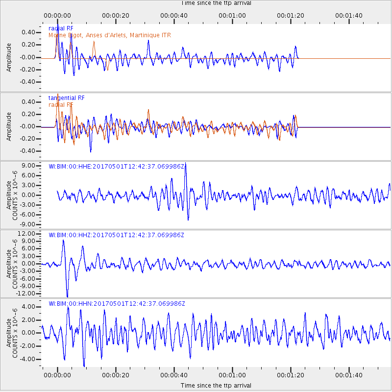
BIM Morne Bigot, Anses d'Arlets, Martinique - Earthquake Result Viewer
*The percent match for this event was below the threshold and hence no stack was calculated.
| Earthquake location: |
Southeastern Alaska |
| Earthquake latitude/longitude: |
59.9/-136.6 |
| Earthquake time(UTC): |
2017/05/01 (121) 12:31:53 GMT |
| Earthquake Depth: |
0.1 km |
| Earthquake Magnitude: |
6.5 Ml |
| Earthquake Catalog/Contributor: |
NEIC PDE/ak |
|
| Network: |
WI West Indies IPGP Network |
| Station: |
BIM Morne Bigot, Anses d'Arlets, Martinique |
| Lat/Lon: |
14.52 N/61.07 W |
| Elevation: |
391 m |
|
| Distance: |
70.3 deg |
| Az: |
95.102 deg |
| Baz: |
328.742 deg |
| Ray Param: |
$rayparam |
*The percent match for this event was below the threshold and hence was not used in the summary stack. |
|
| Radial Match: |
75.370384 % |
| Radial Bump: |
400 |
| Transverse Match: |
67.187164 % |
| Transverse Bump: |
400 |
| SOD ConfigId: |
2028011 |
| Insert Time: |
2017-05-15 12:45:43.182 +0000 |
| GWidth: |
2.5 |
| Max Bumps: |
400 |
| Tol: |
0.001 |
|
Signal To Noise
| Channel | StoN | STA | LTA |
| WI:BIM:00:HHZ:20170501T12:42:37.069986Z | 7.272847 | 5.339435E-6 | 7.341602E-7 |
| WI:BIM:00:HHN:20170501T12:42:37.069986Z | 2.2955022 | 1.955475E-6 | 8.5187236E-7 |
| WI:BIM:00:HHE:20170501T12:42:37.069986Z | 1.622964 | 1.5744173E-6 | 9.700876E-7 |
| Arrivals |
| Ps | |
| PpPs | |
| PsPs/PpSs | |


