You are here: Home > Network List > TS - TERRAscope (Southern California Seismic Network) Stations List
> Station PFO Pinon Flat, California, USA > Earthquake Result Viewer
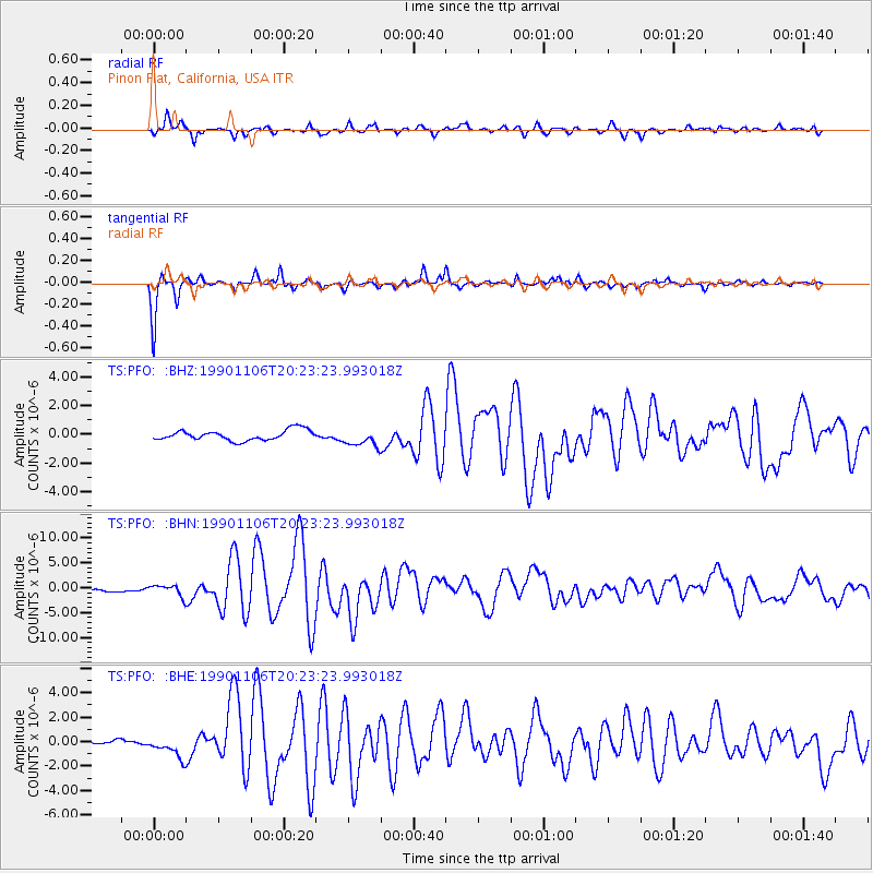
PFO Pinon Flat, California, USA - Earthquake Result Viewer
*The percent match for this event was below the threshold and hence no stack was calculated.
| Earthquake location: |
Komandorskiye Ostrova Region |
| Earthquake latitude/longitude: |
53.5/169.9 |
| Earthquake time(UTC): |
1990/11/06 (310) 20:14:30 GMT |
| Earthquake Depth: |
32 km |
| Earthquake Magnitude: |
6.4 MB, 7.0 MS, 6.8 UNKNOWN |
| Earthquake Catalog/Contributor: |
WHDF/NEIC |
|
| Network: |
TS TERRAscope (Southern California Seismic Network) |
| Station: |
PFO Pinon Flat, California, USA |
| Lat/Lon: |
33.61 N/116.46 W |
| Elevation: |
1280 m |
|
| Distance: |
54.4 deg |
| Az: |
80.034 deg |
| Baz: |
315.124 deg |
| Ray Param: |
$rayparam |
*The percent match for this event was below the threshold and hence was not used in the summary stack. |
|
| Radial Match: |
79.403366 % |
| Radial Bump: |
400 |
| Transverse Match: |
93.29521 % |
| Transverse Bump: |
214 |
| SOD ConfigId: |
4480 |
| Insert Time: |
2010-02-26 14:43:31.214 +0000 |
| GWidth: |
2.5 |
| Max Bumps: |
400 |
| Tol: |
0.001 |
|
Signal To Noise
| Channel | StoN | STA | LTA |
| TS:PFO: :BHN:19901106T20:23:23.993018Z | 3.0100105 | 1.1500745E-6 | 3.8208321E-7 |
| TS:PFO: :BHE:19901106T20:23:23.993018Z | 4.794364 | 9.0404825E-7 | 1.8856478E-7 |
| TS:PFO: :BHZ:19901106T20:23:23.993018Z | 1.7036716 | 6.0848157E-7 | 3.5715897E-7 |
| Arrivals |
| Ps | |
| PpPs | |
| PsPs/PpSs | |


