You are here: Home > Network List > TA - USArray Transportable Network (new EarthScope stations) Stations List
> Station F21K Alatna River, AK, USA > Earthquake Result Viewer
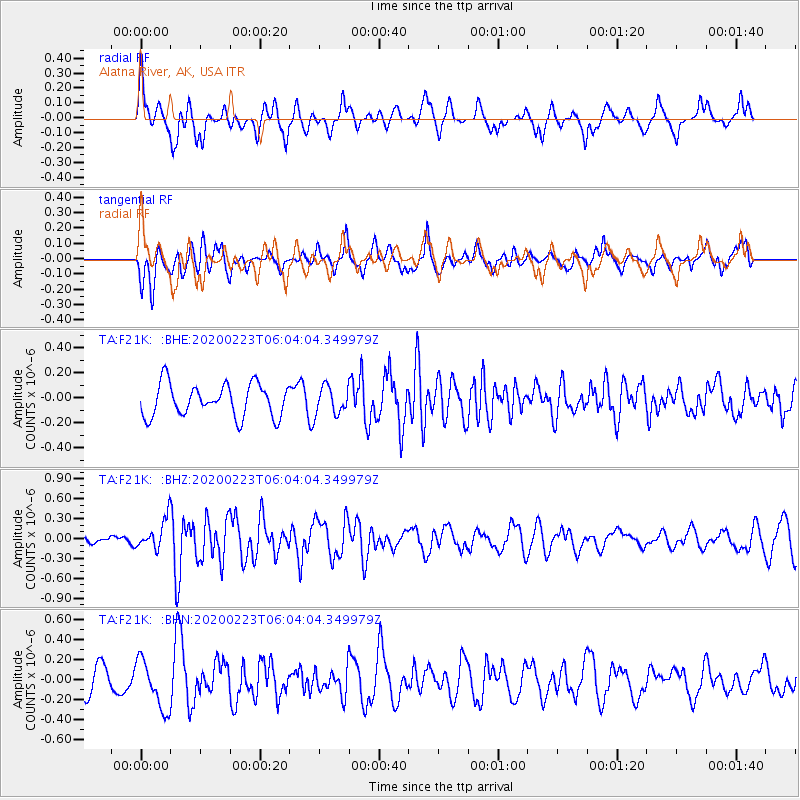
F21K Alatna River, AK, USA - Earthquake Result Viewer
*The percent match for this event was below the threshold and hence no stack was calculated.
| Earthquake location: |
Turkey-Iran Border Region |
| Earthquake latitude/longitude: |
38.5/44.4 |
| Earthquake time(UTC): |
2020/02/23 (054) 05:53:01 GMT |
| Earthquake Depth: |
6.4 km |
| Earthquake Magnitude: |
5.7 mww |
| Earthquake Catalog/Contributor: |
NEIC PDE/us |
|
| Network: |
TA USArray Transportable Network (new EarthScope stations) |
| Station: |
F21K Alatna River, AK, USA |
| Lat/Lon: |
67.22 N/153.48 W |
| Elevation: |
597 m |
|
| Distance: |
73.7 deg |
| Az: |
7.157 deg |
| Baz: |
345.46 deg |
| Ray Param: |
$rayparam |
*The percent match for this event was below the threshold and hence was not used in the summary stack. |
|
| Radial Match: |
65.11619 % |
| Radial Bump: |
400 |
| Transverse Match: |
66.437126 % |
| Transverse Bump: |
400 |
| SOD ConfigId: |
20831131 |
| Insert Time: |
2020-03-22 03:42:35.807 +0000 |
| GWidth: |
2.5 |
| Max Bumps: |
400 |
| Tol: |
0.001 |
|
Signal To Noise
| Channel | StoN | STA | LTA |
| TA:F21K: :BHZ:20200223T06:04:04.349979Z | 2.8092995 | 2.3163383E-7 | 8.245252E-8 |
| TA:F21K: :BHN:20200223T06:04:04.349979Z | 1.8558999 | 2.5040106E-7 | 1.3492165E-7 |
| TA:F21K: :BHE:20200223T06:04:04.349979Z | 0.8384103 | 1.0864259E-7 | 1.2958165E-7 |
| Arrivals |
| Ps | |
| PpPs | |
| PsPs/PpSs | |


