You are here: Home > Network List > TA - USArray Transportable Network (new EarthScope stations) Stations List
> Station F26K Sheenjek River, AK, USA > Earthquake Result Viewer
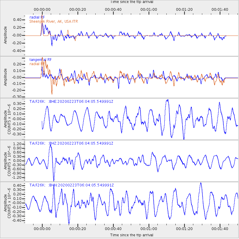
F26K Sheenjek River, AK, USA - Earthquake Result Viewer
*The percent match for this event was below the threshold and hence no stack was calculated.
| Earthquake location: |
Turkey-Iran Border Region |
| Earthquake latitude/longitude: |
38.5/44.4 |
| Earthquake time(UTC): |
2020/02/23 (054) 05:53:01 GMT |
| Earthquake Depth: |
6.4 km |
| Earthquake Magnitude: |
5.7 mww |
| Earthquake Catalog/Contributor: |
NEIC PDE/us |
|
| Network: |
TA USArray Transportable Network (new EarthScope stations) |
| Station: |
F26K Sheenjek River, AK, USA |
| Lat/Lon: |
67.69 N/144.15 W |
| Elevation: |
683 m |
|
| Distance: |
73.9 deg |
| Az: |
3.386 deg |
| Baz: |
353.027 deg |
| Ray Param: |
$rayparam |
*The percent match for this event was below the threshold and hence was not used in the summary stack. |
|
| Radial Match: |
75.43233 % |
| Radial Bump: |
400 |
| Transverse Match: |
71.82318 % |
| Transverse Bump: |
397 |
| SOD ConfigId: |
20831131 |
| Insert Time: |
2020-03-22 03:42:59.332 +0000 |
| GWidth: |
2.5 |
| Max Bumps: |
400 |
| Tol: |
0.001 |
|
Signal To Noise
| Channel | StoN | STA | LTA |
| TA:F26K: :BHZ:20200223T06:04:05.549991Z | 2.2774813 | 4.996279E-7 | 2.193774E-7 |
| TA:F26K: :BHN:20200223T06:04:05.549991Z | 0.7973394 | 1.2177611E-7 | 1.5272808E-7 |
| TA:F26K: :BHE:20200223T06:04:05.549991Z | 0.7268504 | 8.919788E-8 | 1.2271835E-7 |
| Arrivals |
| Ps | |
| PpPs | |
| PsPs/PpSs | |


