You are here: Home > Network List > UW - Pacific Northwest Regional Seismic Network Stations List
> Station UMAT Pilot Rock, OR, USA > Earthquake Result Viewer
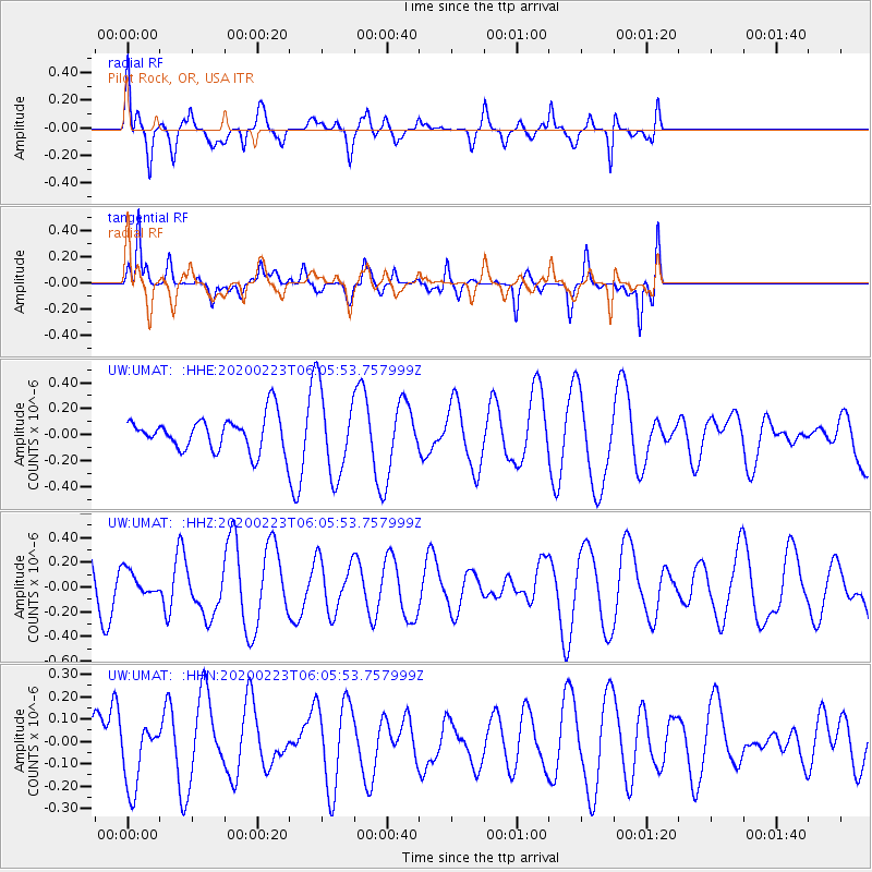
UMAT Pilot Rock, OR, USA - Earthquake Result Viewer
*The percent match for this event was below the threshold and hence no stack was calculated.
| Earthquake location: |
Turkey-Iran Border Region |
| Earthquake latitude/longitude: |
38.5/44.4 |
| Earthquake time(UTC): |
2020/02/23 (054) 05:53:01 GMT |
| Earthquake Depth: |
6.4 km |
| Earthquake Magnitude: |
5.7 mww |
| Earthquake Catalog/Contributor: |
NEIC PDE/us |
|
| Network: |
UW Pacific Northwest Regional Seismic Network |
| Station: |
UMAT Pilot Rock, OR, USA |
| Lat/Lon: |
45.29 N/118.96 W |
| Elevation: |
1318 m |
|
| Distance: |
95.2 deg |
| Az: |
348.291 deg |
| Baz: |
13.036 deg |
| Ray Param: |
$rayparam |
*The percent match for this event was below the threshold and hence was not used in the summary stack. |
|
| Radial Match: |
69.09768 % |
| Radial Bump: |
400 |
| Transverse Match: |
56.4199 % |
| Transverse Bump: |
337 |
| SOD ConfigId: |
20831131 |
| Insert Time: |
2020-03-22 04:12:25.690 +0000 |
| GWidth: |
2.5 |
| Max Bumps: |
400 |
| Tol: |
0.001 |
|
Signal To Noise
| Channel | StoN | STA | LTA |
| UW:UMAT: :HHZ:20200223T06:05:53.757999Z | 0.3945757 | 9.6504145E-8 | 2.4457702E-7 |
| UW:UMAT: :HHN:20200223T06:05:53.757999Z | 0.6462513 | 1.472552E-7 | 2.2786057E-7 |
| UW:UMAT: :HHE:20200223T06:05:53.757999Z | 2.55284 | 3.32634E-7 | 1.302996E-7 |
| Arrivals |
| Ps | |
| PpPs | |
| PsPs/PpSs | |


