You are here: Home > Network List > UW - Pacific Northwest Regional Seismic Network Stations List
> Station HOOD Mt Hood Meadows, OR CREST BB SMO > Earthquake Result Viewer
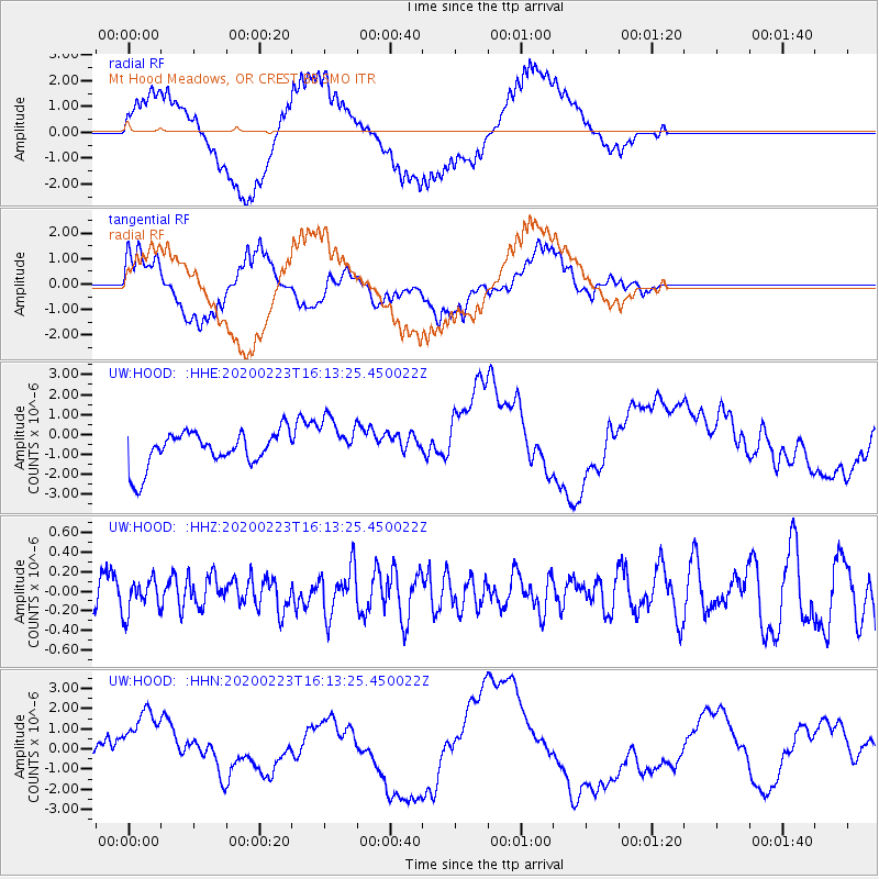
HOOD Mt Hood Meadows, OR CREST BB SMO - Earthquake Result Viewer
*The percent match for this event was below the threshold and hence no stack was calculated.
| Earthquake location: |
Turkey-Iran Border Region |
| Earthquake latitude/longitude: |
38.5/44.4 |
| Earthquake time(UTC): |
2020/02/23 (054) 16:00:31 GMT |
| Earthquake Depth: |
10 km |
| Earthquake Magnitude: |
6.0 mww |
| Earthquake Catalog/Contributor: |
NEIC PDE/us |
|
| Network: |
UW Pacific Northwest Regional Seismic Network |
| Station: |
HOOD Mt Hood Meadows, OR CREST BB SMO |
| Lat/Lon: |
45.32 N/121.65 W |
| Elevation: |
1520 m |
|
| Distance: |
95.6 deg |
| Az: |
350.139 deg |
| Baz: |
10.983 deg |
| Ray Param: |
$rayparam |
*The percent match for this event was below the threshold and hence was not used in the summary stack. |
|
| Radial Match: |
78.10715 % |
| Radial Bump: |
400 |
| Transverse Match: |
43.999825 % |
| Transverse Bump: |
400 |
| SOD ConfigId: |
20831131 |
| Insert Time: |
2020-03-23 14:43:20.963 +0000 |
| GWidth: |
2.5 |
| Max Bumps: |
400 |
| Tol: |
0.001 |
|
Signal To Noise
| Channel | StoN | STA | LTA |
| UW:HOOD: :HHZ:20200223T16:13:25.450022Z | 0.55667895 | 1.7065207E-7 | 3.0655386E-7 |
| UW:HOOD: :HHN:20200223T16:13:25.450022Z | 1.2940931 | 1.7354558E-6 | 1.3410594E-6 |
| UW:HOOD: :HHE:20200223T16:13:25.450022Z | 1.2928472 | 1.1498246E-6 | 8.8937395E-7 |
| Arrivals |
| Ps | |
| PpPs | |
| PsPs/PpSs | |


