You are here: Home > Network List > AV - Alaska Volcano Observatory Stations List
> Station TANO North, Tanaga Volcano, Alaska > Earthquake Result Viewer
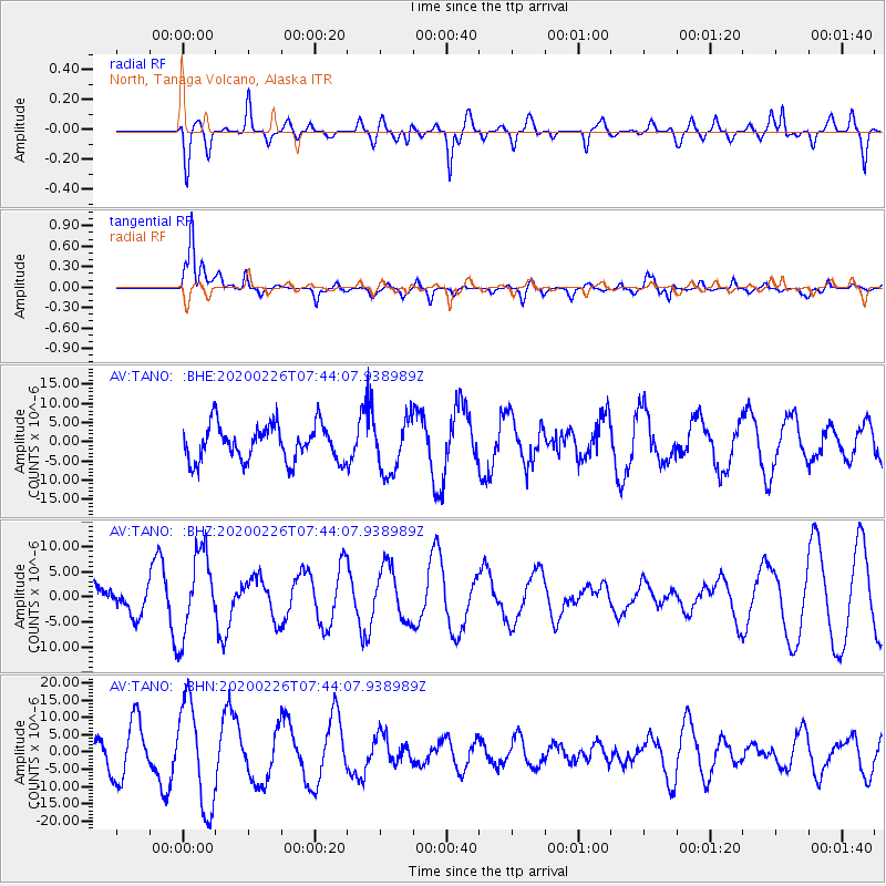
TANO North, Tanaga Volcano, Alaska - Earthquake Result Viewer
*The percent match for this event was below the threshold and hence no stack was calculated.
| Earthquake location: |
Tanimbar Islands Reg., Indonesia |
| Earthquake latitude/longitude: |
-7.6/131.1 |
| Earthquake time(UTC): |
2020/02/26 (057) 07:33:13 GMT |
| Earthquake Depth: |
61 km |
| Earthquake Magnitude: |
5.9 Mww |
| Earthquake Catalog/Contributor: |
NEIC PDE/us |
|
| Network: |
AV Alaska Volcano Observatory |
| Station: |
TANO North, Tanaga Volcano, Alaska |
| Lat/Lon: |
51.91 N/178.12 W |
| Elevation: |
269 m |
|
| Distance: |
73.4 deg |
| Az: |
30.039 deg |
| Baz: |
233.25 deg |
| Ray Param: |
$rayparam |
*The percent match for this event was below the threshold and hence was not used in the summary stack. |
|
| Radial Match: |
45.995373 % |
| Radial Bump: |
400 |
| Transverse Match: |
58.345955 % |
| Transverse Bump: |
400 |
| SOD ConfigId: |
20831131 |
| Insert Time: |
2020-03-26 15:12:47.309 +0000 |
| GWidth: |
2.5 |
| Max Bumps: |
400 |
| Tol: |
0.001 |
|
Signal To Noise
| Channel | StoN | STA | LTA |
| AV:TANO: :BHZ:20200226T07:44:07.938989Z | 2.8240159 | 8.214653E-6 | 2.908855E-6 |
| AV:TANO: :BHN:20200226T07:44:07.938989Z | 2.9306684 | 1.5059191E-5 | 5.138483E-6 |
| AV:TANO: :BHE:20200226T07:44:07.938989Z | 1.4830341 | 6.882761E-6 | 4.641E-6 |
| Arrivals |
| Ps | |
| PpPs | |
| PsPs/PpSs | |


