You are here: Home > Network List > TA - USArray Transportable Network (new EarthScope stations) Stations List
> Station M31M Drury Creek, Yukon, CA > Earthquake Result Viewer
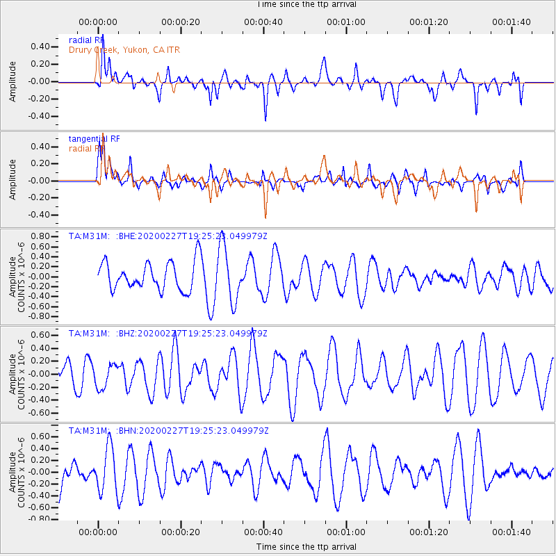
M31M Drury Creek, Yukon, CA - Earthquake Result Viewer
*The percent match for this event was below the threshold and hence no stack was calculated.
| Earthquake location: |
Talaud Islands, Indonesia |
| Earthquake latitude/longitude: |
3.8/125.8 |
| Earthquake time(UTC): |
2020/02/27 (058) 19:13:02 GMT |
| Earthquake Depth: |
122 km |
| Earthquake Magnitude: |
5.5 Mww |
| Earthquake Catalog/Contributor: |
NEIC PDE/us |
|
| Network: |
TA USArray Transportable Network (new EarthScope stations) |
| Station: |
M31M Drury Creek, Yukon, CA |
| Lat/Lon: |
62.20 N/134.39 W |
| Elevation: |
639 m |
|
| Distance: |
91.2 deg |
| Az: |
27.518 deg |
| Baz: |
280.457 deg |
| Ray Param: |
$rayparam |
*The percent match for this event was below the threshold and hence was not used in the summary stack. |
|
| Radial Match: |
55.44711 % |
| Radial Bump: |
400 |
| Transverse Match: |
67.046165 % |
| Transverse Bump: |
400 |
| SOD ConfigId: |
20883691 |
| Insert Time: |
2020-03-27 14:40:46.118 +0000 |
| GWidth: |
2.5 |
| Max Bumps: |
400 |
| Tol: |
0.001 |
|
Signal To Noise
| Channel | StoN | STA | LTA |
| TA:M31M: :BHZ:20200227T19:25:23.049979Z | 0.5710089 | 1.8304135E-7 | 3.2055777E-7 |
| TA:M31M: :BHN:20200227T19:25:23.049979Z | 0.9708788 | 3.866403E-7 | 3.9823743E-7 |
| TA:M31M: :BHE:20200227T19:25:23.049979Z | 2.0269797 | 5.6402007E-7 | 2.782564E-7 |
| Arrivals |
| Ps | |
| PpPs | |
| PsPs/PpSs | |


