You are here: Home > Network List > TA - USArray Transportable Network (new EarthScope stations) Stations List
> Station R31K City Hall, Gustavus, AK, USA > Earthquake Result Viewer
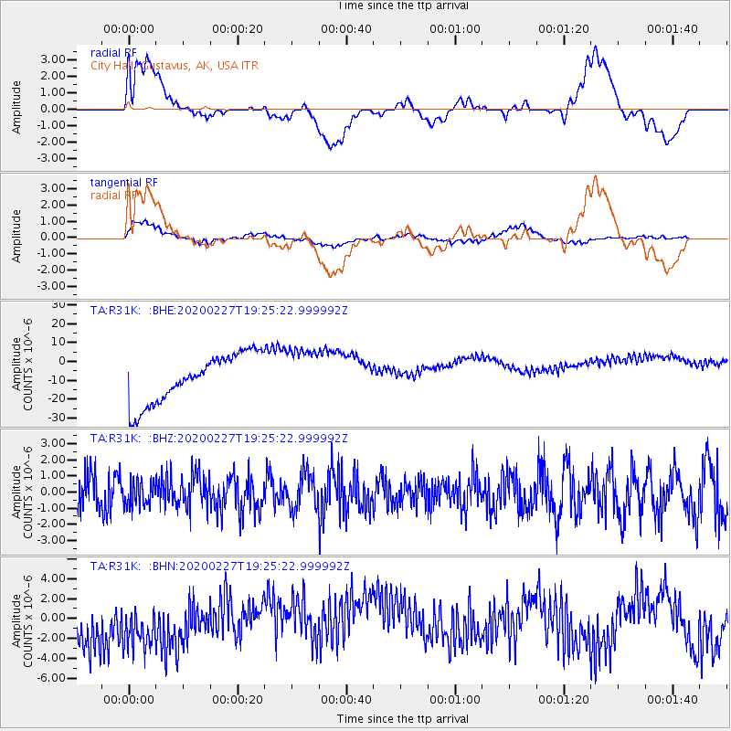
R31K City Hall, Gustavus, AK, USA - Earthquake Result Viewer
*The percent match for this event was below the threshold and hence no stack was calculated.
| Earthquake location: |
Talaud Islands, Indonesia |
| Earthquake latitude/longitude: |
3.8/125.8 |
| Earthquake time(UTC): |
2020/02/27 (058) 19:13:02 GMT |
| Earthquake Depth: |
122 km |
| Earthquake Magnitude: |
5.5 Mww |
| Earthquake Catalog/Contributor: |
NEIC PDE/us |
|
| Network: |
TA USArray Transportable Network (new EarthScope stations) |
| Station: |
R31K City Hall, Gustavus, AK, USA |
| Lat/Lon: |
58.41 N/135.74 W |
| Elevation: |
15 m |
|
| Distance: |
91.2 deg |
| Az: |
31.379 deg |
| Baz: |
279.204 deg |
| Ray Param: |
$rayparam |
*The percent match for this event was below the threshold and hence was not used in the summary stack. |
|
| Radial Match: |
21.32543 % |
| Radial Bump: |
400 |
| Transverse Match: |
42.950302 % |
| Transverse Bump: |
400 |
| SOD ConfigId: |
20883691 |
| Insert Time: |
2020-03-27 14:43:24.491 +0000 |
| GWidth: |
2.5 |
| Max Bumps: |
400 |
| Tol: |
0.001 |
|
Signal To Noise
| Channel | StoN | STA | LTA |
| TA:R31K: :BHZ:20200227T19:25:22.999992Z | 0.79171836 | 7.5708454E-7 | 9.562549E-7 |
| TA:R31K: :BHN:20200227T19:25:22.999992Z | 0.9617279 | 4.033279E-6 | 4.1937838E-6 |
| TA:R31K: :BHE:20200227T19:25:22.999992Z | 1.0761542 | 1.3750043E-5 | 1.277702E-5 |
| Arrivals |
| Ps | |
| PpPs | |
| PsPs/PpSs | |


