You are here: Home > Network List > CI - Caltech Regional Seismic Network Stations List
> Station TIN Tinemaha, Big Pine, CA, USA > Earthquake Result Viewer
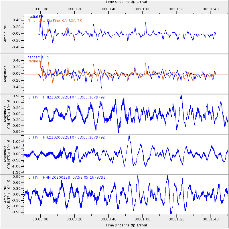
TIN Tinemaha, Big Pine, CA, USA - Earthquake Result Viewer
*The percent match for this event was below the threshold and hence no stack was calculated.
| Earthquake location: |
Tonga Islands Region |
| Earthquake latitude/longitude: |
-18.9/-172.9 |
| Earthquake time(UTC): |
2020/02/28 (059) 07:41:50 GMT |
| Earthquake Depth: |
10 km |
| Earthquake Magnitude: |
5.8 Mww |
| Earthquake Catalog/Contributor: |
NEIC PDE/us |
|
| Network: |
CI Caltech Regional Seismic Network |
| Station: |
TIN Tinemaha, Big Pine, CA, USA |
| Lat/Lon: |
37.05 N/118.23 W |
| Elevation: |
1197 m |
|
| Distance: |
75.8 deg |
| Az: |
42.325 deg |
| Baz: |
232.833 deg |
| Ray Param: |
$rayparam |
*The percent match for this event was below the threshold and hence was not used in the summary stack. |
|
| Radial Match: |
68.227905 % |
| Radial Bump: |
400 |
| Transverse Match: |
57.942997 % |
| Transverse Bump: |
400 |
| SOD ConfigId: |
20883691 |
| Insert Time: |
2020-03-29 08:19:37.391 +0000 |
| GWidth: |
2.5 |
| Max Bumps: |
400 |
| Tol: |
0.001 |
|
Signal To Noise
| Channel | StoN | STA | LTA |
| CI:TIN: :HHZ:20200228T07:53:05.167979Z | 0.90415394 | 1.12509426E-7 | 1.2443614E-7 |
| CI:TIN: :HHN:20200228T07:53:05.167979Z | 0.846931 | 2.289948E-7 | 2.703819E-7 |
| CI:TIN: :HHE:20200228T07:53:05.167979Z | 1.9992671 | 4.3996076E-7 | 2.2006103E-7 |
| Arrivals |
| Ps | |
| PpPs | |
| PsPs/PpSs | |


