You are here: Home > Network List > US - United States National Seismic Network Stations List
> Station AMTX Amarillo, Texas, USA > Earthquake Result Viewer
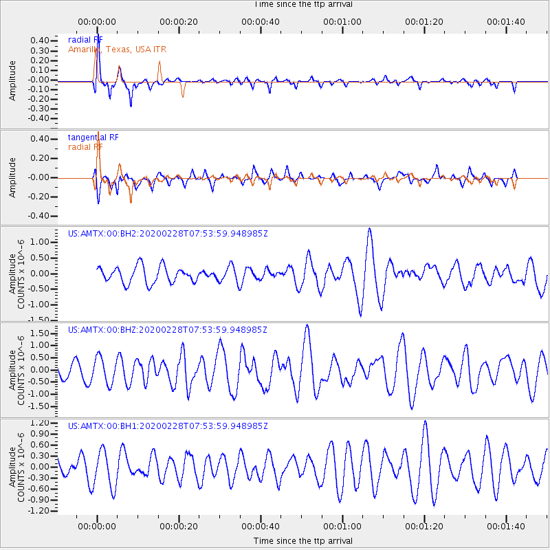
AMTX Amarillo, Texas, USA - Earthquake Result Viewer
*The percent match for this event was below the threshold and hence no stack was calculated.
| Earthquake location: |
Tonga Islands Region |
| Earthquake latitude/longitude: |
-18.9/-172.9 |
| Earthquake time(UTC): |
2020/02/28 (059) 07:41:50 GMT |
| Earthquake Depth: |
10 km |
| Earthquake Magnitude: |
5.8 Mww |
| Earthquake Catalog/Contributor: |
NEIC PDE/us |
|
| Network: |
US United States National Seismic Network |
| Station: |
AMTX Amarillo, Texas, USA |
| Lat/Lon: |
34.53 N/101.41 W |
| Elevation: |
1010 m |
|
| Distance: |
86.2 deg |
| Az: |
51.696 deg |
| Baz: |
244.148 deg |
| Ray Param: |
$rayparam |
*The percent match for this event was below the threshold and hence was not used in the summary stack. |
|
| Radial Match: |
66.66277 % |
| Radial Bump: |
328 |
| Transverse Match: |
44.795265 % |
| Transverse Bump: |
361 |
| SOD ConfigId: |
20883691 |
| Insert Time: |
2020-03-29 10:41:20.311 +0000 |
| GWidth: |
2.5 |
| Max Bumps: |
400 |
| Tol: |
0.001 |
|
Signal To Noise
| Channel | StoN | STA | LTA |
| US:AMTX:00:BHZ:20200228T07:53:59.948985Z | 1.8320004 | 5.322996E-7 | 2.9055647E-7 |
| US:AMTX:00:BH1:20200228T07:53:59.948985Z | 1.4168444 | 5.017642E-7 | 3.5414206E-7 |
| US:AMTX:00:BH2:20200228T07:53:59.948985Z | 1.0777048 | 2.809155E-7 | 2.606609E-7 |
| Arrivals |
| Ps | |
| PpPs | |
| PsPs/PpSs | |


