You are here: Home > Network List > TS - TERRAscope (Southern California Seismic Network) Stations List
> Station PFO Pinon Flat, California, USA > Earthquake Result Viewer
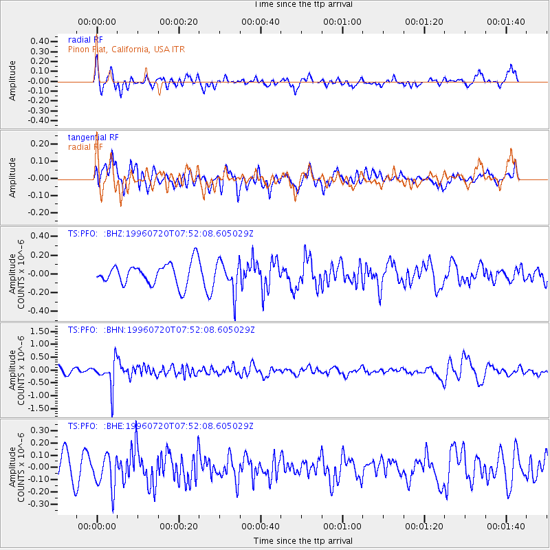
PFO Pinon Flat, California, USA - Earthquake Result Viewer
*The percent match for this event was below the threshold and hence no stack was calculated.
| Earthquake location: |
Fiji Islands Region |
| Earthquake latitude/longitude: |
-19.8/-177.6 |
| Earthquake time(UTC): |
1996/07/20 (202) 07:41:15 GMT |
| Earthquake Depth: |
357 km |
| Earthquake Magnitude: |
5.7 MB, 5.9 UNKNOWN, 5.8 MW |
| Earthquake Catalog/Contributor: |
WHDF/NEIC |
|
| Network: |
TS TERRAscope (Southern California Seismic Network) |
| Station: |
PFO Pinon Flat, California, USA |
| Lat/Lon: |
33.61 N/116.46 W |
| Elevation: |
1280 m |
|
| Distance: |
78.9 deg |
| Az: |
48.179 deg |
| Baz: |
237.218 deg |
| Ray Param: |
$rayparam |
*The percent match for this event was below the threshold and hence was not used in the summary stack. |
|
| Radial Match: |
66.77112 % |
| Radial Bump: |
400 |
| Transverse Match: |
37.253098 % |
| Transverse Bump: |
400 |
| SOD ConfigId: |
4480 |
| Insert Time: |
2010-02-26 14:43:33.615 +0000 |
| GWidth: |
2.5 |
| Max Bumps: |
400 |
| Tol: |
0.001 |
|
Signal To Noise
| Channel | StoN | STA | LTA |
| TS:PFO: :BHN:19960720T07:52:08.605029Z | 5.2421055 | 5.5062645E-7 | 1.0503918E-7 |
| TS:PFO: :BHE:19960720T07:52:08.605029Z | 1.4724717 | 1.409938E-7 | 9.575315E-8 |
| TS:PFO: :BHZ:19960720T07:52:08.605029Z | 1.4704319 | 1.6858525E-7 | 1.1465015E-7 |
| Arrivals |
| Ps | |
| PpPs | |
| PsPs/PpSs | |


