You are here: Home > Network List > GS - US Geological Survey Networks Stations List
> Station KAN08 Pence Farm, Harper, KS, USA > Earthquake Result Viewer
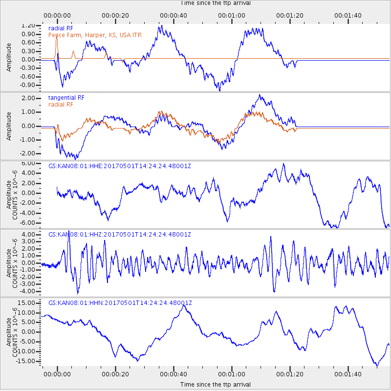
KAN08 Pence Farm, Harper, KS, USA - Earthquake Result Viewer
*The percent match for this event was below the threshold and hence no stack was calculated.
| Earthquake location: |
Southeastern Alaska |
| Earthquake latitude/longitude: |
59.8/-136.6 |
| Earthquake time(UTC): |
2017/05/01 (121) 14:18:15 GMT |
| Earthquake Depth: |
3.3 km |
| Earthquake Magnitude: |
6.3 Ml |
| Earthquake Catalog/Contributor: |
NEIC PDE/ak |
|
| Network: |
GS US Geological Survey Networks |
| Station: |
KAN08 Pence Farm, Harper, KS, USA |
| Lat/Lon: |
37.23 N/97.97 W |
| Elevation: |
375 m |
|
| Distance: |
33.4 deg |
| Az: |
115.15 deg |
| Baz: |
325.077 deg |
| Ray Param: |
$rayparam |
*The percent match for this event was below the threshold and hence was not used in the summary stack. |
|
| Radial Match: |
20.950773 % |
| Radial Bump: |
400 |
| Transverse Match: |
25.32642 % |
| Transverse Bump: |
400 |
| SOD ConfigId: |
2028011 |
| Insert Time: |
2017-05-15 14:22:51.252 +0000 |
| GWidth: |
2.5 |
| Max Bumps: |
400 |
| Tol: |
0.001 |
|
Signal To Noise
| Channel | StoN | STA | LTA |
| GS:KAN08:01:HHZ:20170501T14:24:24.48001Z | 5.840693 | 1.6302043E-6 | 2.7911145E-7 |
| GS:KAN08:01:HHN:20170501T14:24:24.48001Z | 1.7894979 | 6.2379563E-6 | 3.48587E-6 |
| GS:KAN08:01:HHE:20170501T14:24:24.48001Z | 1.5785569 | 2.651449E-6 | 1.6796664E-6 |
| Arrivals |
| Ps | |
| PpPs | |
| PsPs/PpSs | |


