You are here: Home > Network List > GS - US Geological Survey Networks Stations List
> Station KAN13 Rinehart Farm > Earthquake Result Viewer
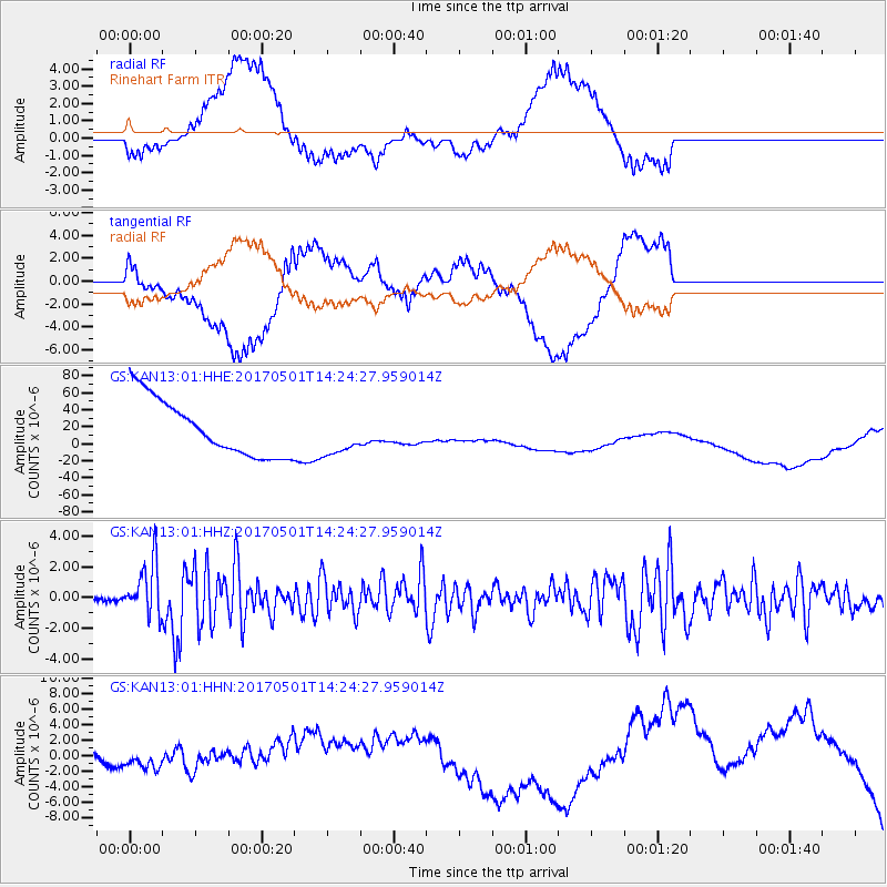
KAN13 Rinehart Farm - Earthquake Result Viewer
*The percent match for this event was below the threshold and hence no stack was calculated.
| Earthquake location: |
Southeastern Alaska |
| Earthquake latitude/longitude: |
59.8/-136.6 |
| Earthquake time(UTC): |
2017/05/01 (121) 14:18:15 GMT |
| Earthquake Depth: |
3.3 km |
| Earthquake Magnitude: |
6.3 Ml |
| Earthquake Catalog/Contributor: |
NEIC PDE/ak |
|
| Network: |
GS US Geological Survey Networks |
| Station: |
KAN13 Rinehart Farm |
| Lat/Lon: |
37.01 N/97.48 W |
| Elevation: |
340 m |
|
| Distance: |
33.8 deg |
| Az: |
114.787 deg |
| Baz: |
325.071 deg |
| Ray Param: |
$rayparam |
*The percent match for this event was below the threshold and hence was not used in the summary stack. |
|
| Radial Match: |
35.702267 % |
| Radial Bump: |
400 |
| Transverse Match: |
34.20204 % |
| Transverse Bump: |
400 |
| SOD ConfigId: |
2028011 |
| Insert Time: |
2017-05-15 14:23:00.811 +0000 |
| GWidth: |
2.5 |
| Max Bumps: |
400 |
| Tol: |
0.001 |
|
Signal To Noise
| Channel | StoN | STA | LTA |
| GS:KAN13:01:HHZ:20170501T14:24:27.959014Z | 5.8011 | 1.725424E-6 | 2.974305E-7 |
| GS:KAN13:01:HHN:20170501T14:24:27.959014Z | 0.7443843 | 1.2411426E-6 | 1.6673413E-6 |
| GS:KAN13:01:HHE:20170501T14:24:27.959014Z | 0.7484967 | 2.4684476E-5 | 3.297874E-5 |
| Arrivals |
| Ps | |
| PpPs | |
| PsPs/PpSs | |


