You are here: Home > Network List > IW - Intermountain West Stations List
> Station MOOW Moose Ponds, Wyoming, USA > Earthquake Result Viewer
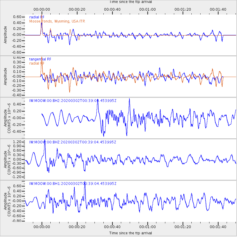
MOOW Moose Ponds, Wyoming, USA - Earthquake Result Viewer
*The percent match for this event was below the threshold and hence no stack was calculated.
| Earthquake location: |
Andreanof Islands, Aleutian Is. |
| Earthquake latitude/longitude: |
51.1/-179.9 |
| Earthquake time(UTC): |
2020/03/02 (062) 00:31:16 GMT |
| Earthquake Depth: |
24 km |
| Earthquake Magnitude: |
5.7 mww |
| Earthquake Catalog/Contributor: |
NEIC PDE/us |
|
| Network: |
IW Intermountain West |
| Station: |
MOOW Moose Ponds, Wyoming, USA |
| Lat/Lon: |
43.75 N/110.74 W |
| Elevation: |
2128 m |
|
| Distance: |
45.7 deg |
| Az: |
70.975 deg |
| Baz: |
304.722 deg |
| Ray Param: |
$rayparam |
*The percent match for this event was below the threshold and hence was not used in the summary stack. |
|
| Radial Match: |
69.92389 % |
| Radial Bump: |
400 |
| Transverse Match: |
51.66617 % |
| Transverse Bump: |
400 |
| SOD ConfigId: |
20883691 |
| Insert Time: |
2020-03-31 16:31:28.328 +0000 |
| GWidth: |
2.5 |
| Max Bumps: |
400 |
| Tol: |
0.001 |
|
Signal To Noise
| Channel | StoN | STA | LTA |
| IW:MOOW:00:BHZ:20200302T00:39:04.453995Z | 3.5681725 | 5.4422924E-7 | 1.5252324E-7 |
| IW:MOOW:00:BH1:20200302T00:39:04.453995Z | 1.7749686 | 2.2397614E-7 | 1.2618598E-7 |
| IW:MOOW:00:BH2:20200302T00:39:04.453995Z | 2.057618 | 2.4012465E-7 | 1.167003E-7 |
| Arrivals |
| Ps | |
| PpPs | |
| PsPs/PpSs | |


