S234 Frontage Road - Earthquake Result Viewer
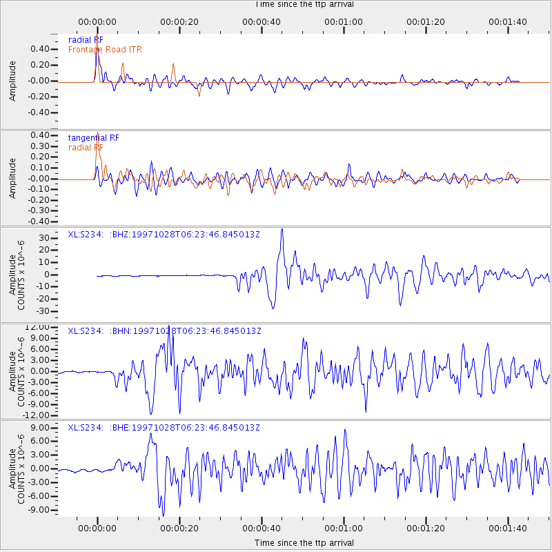
Earthquake location: Northern Peru
Earthquake latitude/longitude: -4.4/-76.7
Earthquake time(UTC): 1997/10/28 (301) 06:15:17 GMT
Earthquake Depth: 112 km
Earthquake Magnitude: 6.6 MB, 6.3 MS, 7.2 UNKNOWN, 6.6 ME
Earthquake Catalog/Contributor: WHDF/NEIC
Network: XL Deep Probe (Archean-Proterozoic)
Station: S234 Frontage Road
Lat/Lon: 39.36 N/108.15 W
Elevation: 1509 m
Distance: 52.3 deg
Az: 329.234 deg
Baz: 138.857 deg
Ray Param: 0.06649211
Estimated Moho Depth: 45.25 km
Estimated Crust Vp/Vs: 1.96
Assumed Crust Vp: 6.291 km/s
Estimated Crust Vs: 3.205 km/s
Estimated Crust Poisson's Ratio: 0.32
Radial Match: 90.32888 %
Radial Bump: 400
Transverse Match: 77.63519 %
Transverse Bump: 400
SOD ConfigId: 6273
Insert Time: 2010-03-08 18:09:01.966 +0000
GWidth: 2.5
Max Bumps: 400
Tol: 0.001

Signal To Noise

ChannelStoNSTALTA
XL:S234: :BHN:19971028T06:23:46.845013Z4.8388851.2215007E-62.5243435E-7
XL:S234: :BHE:19971028T06:23:46.845013Z3.32176616.020281E-71.8123734E-7
XL:S234: :BHZ:19971028T06:23:46.845013Z15.1461483.850072E-62.5419482E-7
Arrivals
Ps7.3 SECOND
PpPs20 SECOND
PsPs/PpSs28 SECOND