You are here: Home > Network List > IU - Global Seismograph Network (GSN - IRIS/USGS) Stations List
> Station WVT Waverly, Tennessee, USA > Earthquake Result Viewer
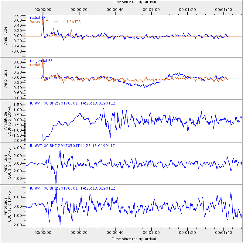
WVT Waverly, Tennessee, USA - Earthquake Result Viewer
*The percent match for this event was below the threshold and hence no stack was calculated.
| Earthquake location: |
Southeastern Alaska |
| Earthquake latitude/longitude: |
59.8/-136.6 |
| Earthquake time(UTC): |
2017/05/01 (121) 14:18:15 GMT |
| Earthquake Depth: |
3.3 km |
| Earthquake Magnitude: |
6.3 Ml |
| Earthquake Catalog/Contributor: |
NEIC PDE/ak |
|
| Network: |
IU Global Seismograph Network (GSN - IRIS/USGS) |
| Station: |
WVT Waverly, Tennessee, USA |
| Lat/Lon: |
36.13 N/87.83 W |
| Elevation: |
170 m |
|
| Distance: |
39.1 deg |
| Az: |
105.079 deg |
| Baz: |
322.981 deg |
| Ray Param: |
$rayparam |
*The percent match for this event was below the threshold and hence was not used in the summary stack. |
|
| Radial Match: |
78.448235 % |
| Radial Bump: |
400 |
| Transverse Match: |
35.422653 % |
| Transverse Bump: |
400 |
| SOD ConfigId: |
2028011 |
| Insert Time: |
2017-05-15 14:26:42.720 +0000 |
| GWidth: |
2.5 |
| Max Bumps: |
400 |
| Tol: |
0.001 |
|
Signal To Noise
| Channel | StoN | STA | LTA |
| IU:WVT:00:BHZ:20170501T14:25:13.019011Z | 3.910483 | 7.9066837E-7 | 2.0219201E-7 |
| IU:WVT:00:BH1:20170501T14:25:13.019011Z | 0.9869941 | 6.5014996E-7 | 6.5871717E-7 |
| IU:WVT:00:BH2:20170501T14:25:13.019011Z | 1.0803459 | 7.589077E-7 | 7.0246733E-7 |
| Arrivals |
| Ps | |
| PpPs | |
| PsPs/PpSs | |


