You are here: Home > Network List > US - United States National Seismic Network Stations List
> Station EGMT Eagleton, Montana, USA > Earthquake Result Viewer
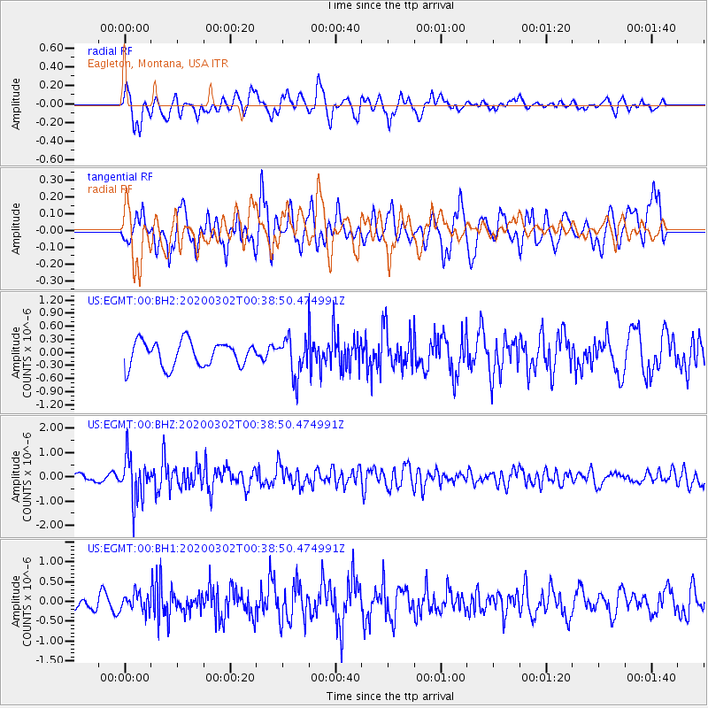
EGMT Eagleton, Montana, USA - Earthquake Result Viewer
*The percent match for this event was below the threshold and hence no stack was calculated.
| Earthquake location: |
Andreanof Islands, Aleutian Is. |
| Earthquake latitude/longitude: |
51.1/-179.9 |
| Earthquake time(UTC): |
2020/03/02 (062) 00:31:16 GMT |
| Earthquake Depth: |
24 km |
| Earthquake Magnitude: |
5.7 mww |
| Earthquake Catalog/Contributor: |
NEIC PDE/us |
|
| Network: |
US United States National Seismic Network |
| Station: |
EGMT Eagleton, Montana, USA |
| Lat/Lon: |
48.02 N/109.75 W |
| Elevation: |
1055 m |
|
| Distance: |
44.0 deg |
| Az: |
65.36 deg |
| Baz: |
301.449 deg |
| Ray Param: |
$rayparam |
*The percent match for this event was below the threshold and hence was not used in the summary stack. |
|
| Radial Match: |
62.138752 % |
| Radial Bump: |
400 |
| Transverse Match: |
66.51569 % |
| Transverse Bump: |
400 |
| SOD ConfigId: |
20883691 |
| Insert Time: |
2020-03-31 18:57:25.267 +0000 |
| GWidth: |
2.5 |
| Max Bumps: |
400 |
| Tol: |
0.001 |
|
Signal To Noise
| Channel | StoN | STA | LTA |
| US:EGMT:00:BHZ:20200302T00:38:50.474991Z | 5.6772404 | 9.17027E-7 | 1.615269E-7 |
| US:EGMT:00:BH1:20200302T00:38:50.474991Z | 1.1311156 | 2.1888582E-7 | 1.9351322E-7 |
| US:EGMT:00:BH2:20200302T00:38:50.474991Z | 1.5592144 | 4.464614E-7 | 2.863374E-7 |
| Arrivals |
| Ps | |
| PpPs | |
| PsPs/PpSs | |


