You are here: Home > Network List > US - United States National Seismic Network Stations List
> Station HAWA Hanford, Washington, USA > Earthquake Result Viewer
HAWA Hanford, Washington, USA - Earthquake Result Viewer
*The percent match for this event was below the threshold and hence no stack was calculated.
| Earthquake location: |
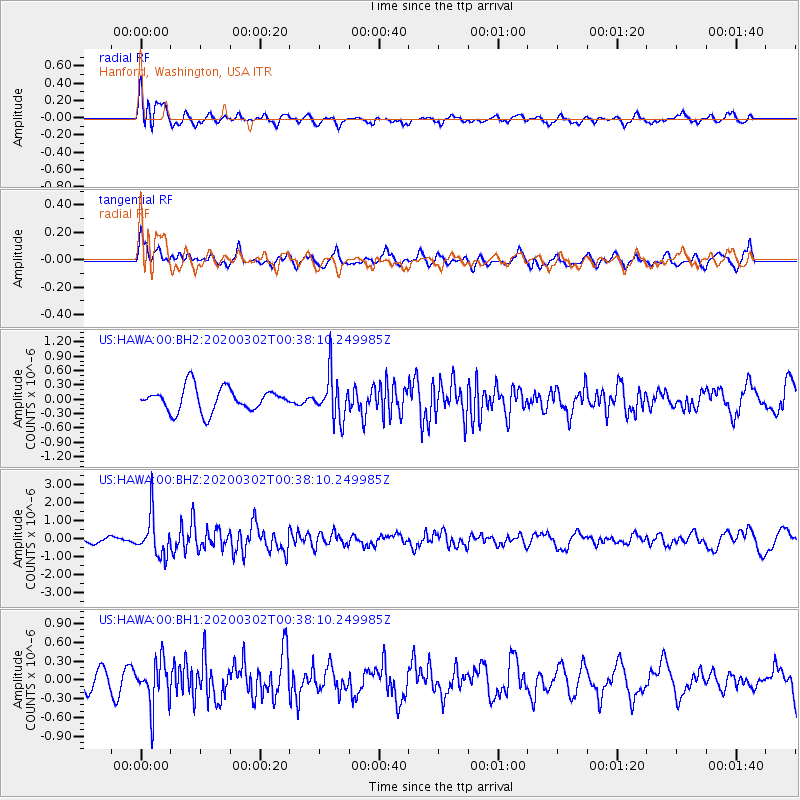
Andreanof Islands, Aleutian Is. |
| Earthquake latitude/longitude: |
51.1/-179.9 |
| Earthquake time(UTC): |
2020/03/02 (062) 00:31:16 GMT |
| Earthquake Depth: |
24 km |
| Earthquake Magnitude: |
5.7 mww |
| Earthquake Catalog/Contributor: |
NEIC PDE/us |
|
| Network: |
US United States National Seismic Network |
| Station: |
HAWA Hanford, Washington, USA |
| Lat/Lon: |
46.39 N/119.53 W |
| Elevation: |
364 m |
|
| Distance: |
39.1 deg |
| Az: |
72.586 deg |
| Baz: |
299.705 deg |
| Ray Param: |
$rayparam |
*The percent match for this event was below the threshold and hence was not used in the summary stack. |
|
| Radial Match: |
62.577465 % |
| Radial Bump: |
400 |
| Transverse Match: |
60.291756 % |
| Transverse Bump: |
400 |
| SOD ConfigId: |
20883691 |
| Insert Time: |
2020-03-31 18:57:59.000 +0000 |
| GWidth: |
2.5 |
| Max Bumps: |
400 |
| Tol: |
0.001 |
|
Signal To Noise
| Channel | StoN | STA | LTA |
| US:HAWA:00:BHZ:20200302T00:38:10.249985Z | 4.010138 | 1.110724E-6 | 2.7697902E-7 |
| US:HAWA:00:BH1:20200302T00:38:10.249985Z | 2.4339368 | 3.6368715E-7 | 1.4942341E-7 |
| US:HAWA:00:BH2:20200302T00:38:10.249985Z | 1.8643414 | 4.5846315E-7 | 2.459116E-7 |
| Arrivals |
| Ps | |
| PpPs | |
| PsPs/PpSs | |


