You are here: Home > Network List > TS - TERRAscope (Southern California Seismic Network) Stations List
> Station PFO Pinon Flat, California, USA > Earthquake Result Viewer
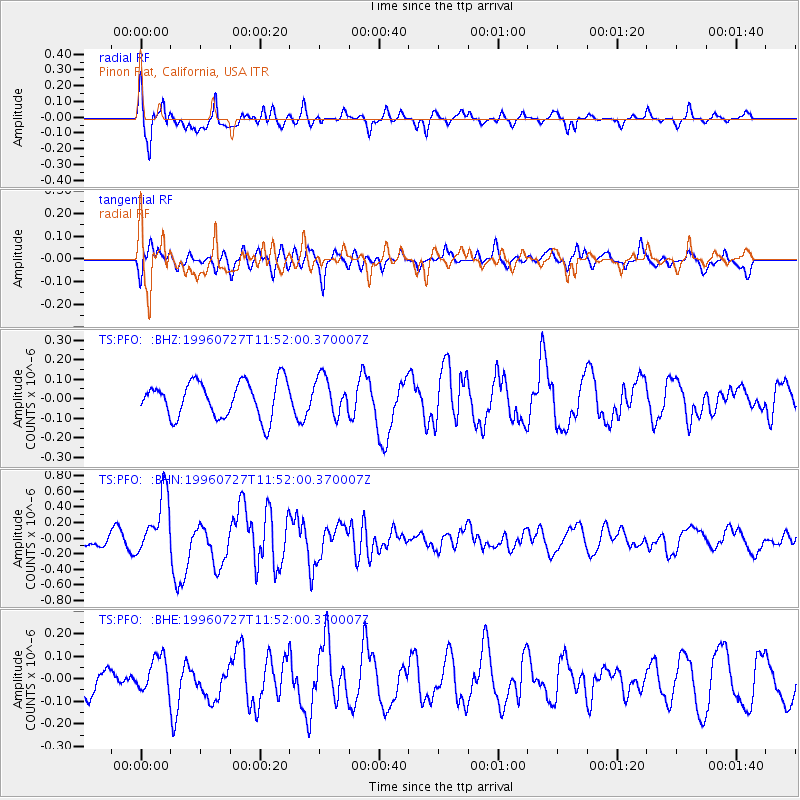
PFO Pinon Flat, California, USA - Earthquake Result Viewer
*The percent match for this event was below the threshold and hence no stack was calculated.
| Earthquake location: |
Kermadec Islands Region |
| Earthquake latitude/longitude: |
-28.7/-177.5 |
| Earthquake time(UTC): |
1996/07/27 (209) 11:40:02 GMT |
| Earthquake Depth: |
48 km |
| Earthquake Magnitude: |
5.6 MB, 5.5 MS, 5.9 UNKNOWN |
| Earthquake Catalog/Contributor: |
WHDF/NEIC |
|
| Network: |
TS TERRAscope (Southern California Seismic Network) |
| Station: |
PFO Pinon Flat, California, USA |
| Lat/Lon: |
33.61 N/116.46 W |
| Elevation: |
1280 m |
|
| Distance: |
84.7 deg |
| Az: |
47.149 deg |
| Baz: |
230.54 deg |
| Ray Param: |
$rayparam |
*The percent match for this event was below the threshold and hence was not used in the summary stack. |
|
| Radial Match: |
79.64266 % |
| Radial Bump: |
400 |
| Transverse Match: |
70.82358 % |
| Transverse Bump: |
400 |
| SOD ConfigId: |
4480 |
| Insert Time: |
2010-02-26 14:43:37.155 +0000 |
| GWidth: |
2.5 |
| Max Bumps: |
400 |
| Tol: |
0.001 |
|
Signal To Noise
| Channel | StoN | STA | LTA |
| TS:PFO: :BHN:19960727T11:52:00.370007Z | 3.0345626 | 3.9287542E-7 | 1.294669E-7 |
| TS:PFO: :BHE:19960727T11:52:00.370007Z | 1.0682627 | 7.938912E-8 | 7.43161E-8 |
| TS:PFO: :BHZ:19960727T11:52:00.370007Z | 1.0450462 | 9.512143E-8 | 9.102126E-8 |
| Arrivals |
| Ps | |
| PpPs | |
| PsPs/PpSs | |


