You are here: Home > Network List > TS - TERRAscope (Southern California Seismic Network) Stations List
> Station PFO Pinon Flat, California, USA > Earthquake Result Viewer
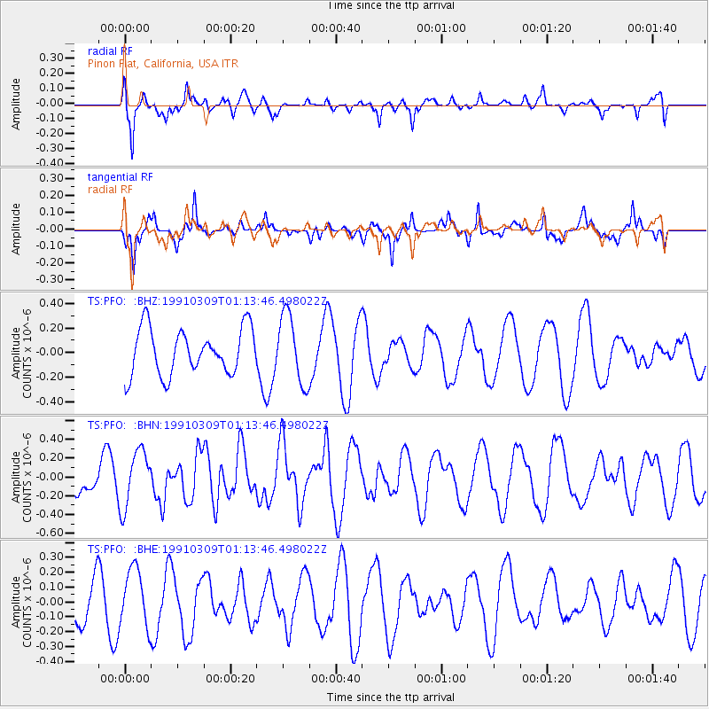
PFO Pinon Flat, California, USA - Earthquake Result Viewer
*The percent match for this event was below the threshold and hence no stack was calculated.
| Earthquake location: |
Pacific-Antarctic Ridge |
| Earthquake latitude/longitude: |
-54.8/-131.5 |
| Earthquake time(UTC): |
1991/03/09 (068) 01:01:22 GMT |
| Earthquake Depth: |
10 km |
| Earthquake Magnitude: |
5.9 MB, 5.8 MS |
| Earthquake Catalog/Contributor: |
WHDF/NEIC |
|
| Network: |
TS TERRAscope (Southern California Seismic Network) |
| Station: |
PFO Pinon Flat, California, USA |
| Lat/Lon: |
33.61 N/116.46 W |
| Elevation: |
1280 m |
|
| Distance: |
89.0 deg |
| Az: |
12.553 deg |
| Baz: |
188.664 deg |
| Ray Param: |
$rayparam |
*The percent match for this event was below the threshold and hence was not used in the summary stack. |
|
| Radial Match: |
61.06109 % |
| Radial Bump: |
379 |
| Transverse Match: |
60.512547 % |
| Transverse Bump: |
302 |
| SOD ConfigId: |
4480 |
| Insert Time: |
2010-02-26 14:43:37.569 +0000 |
| GWidth: |
2.5 |
| Max Bumps: |
400 |
| Tol: |
0.001 |
|
Signal To Noise
| Channel | StoN | STA | LTA |
| TS:PFO: :BHN:19910309T01:13:46.498022Z | 2.4365172 | 3.026275E-7 | 1.2420494E-7 |
| TS:PFO: :BHE:19910309T01:13:46.498022Z | 1.6675022 | 1.9659358E-7 | 1.1789705E-7 |
| TS:PFO: :BHZ:19910309T01:13:46.498022Z | 1.5231566 | 2.8369834E-7 | 1.8625683E-7 |
| Arrivals |
| Ps | |
| PpPs | |
| PsPs/PpSs | |


