You are here: Home > Network List > TA - USArray Transportable Network (new EarthScope stations) Stations List
> Station I17K Unalakleet, AK, USA > Earthquake Result Viewer
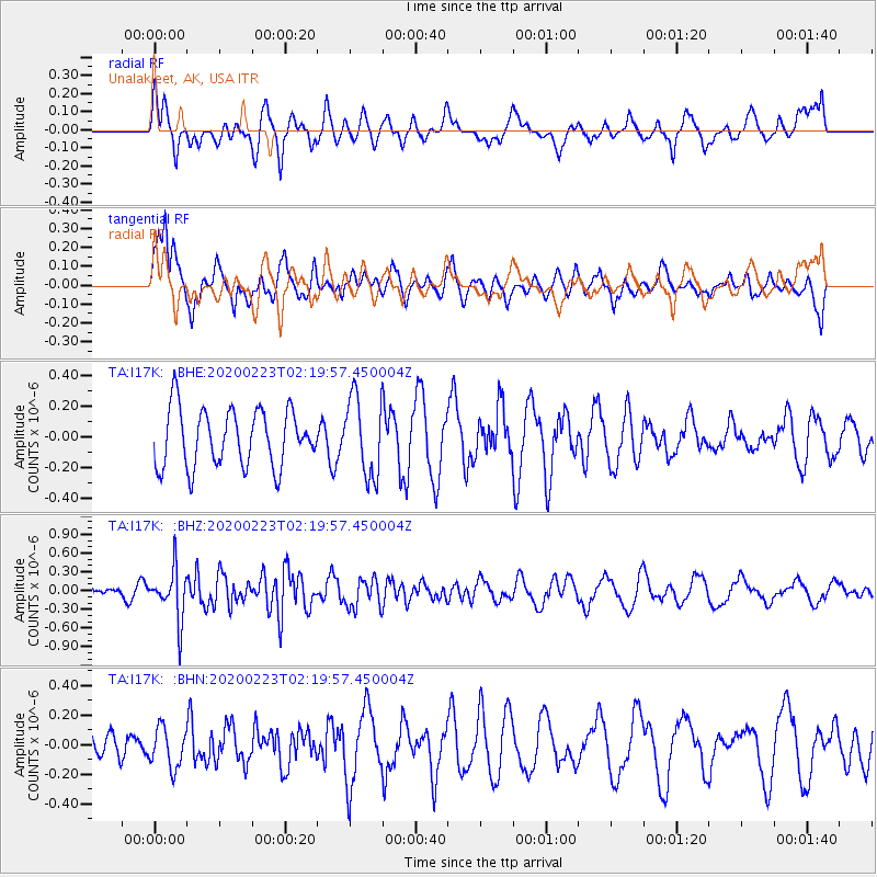
I17K Unalakleet, AK, USA - Earthquake Result Viewer
*The percent match for this event was below the threshold and hence no stack was calculated.
| Earthquake location: |
Southern Molucca Sea |
| Earthquake latitude/longitude: |
-0.2/125.2 |
| Earthquake time(UTC): |
2020/02/23 (054) 02:08:04 GMT |
| Earthquake Depth: |
24 km |
| Earthquake Magnitude: |
5.3 Mww |
| Earthquake Catalog/Contributor: |
NEIC PDE/us |
|
| Network: |
TA USArray Transportable Network (new EarthScope stations) |
| Station: |
I17K Unalakleet, AK, USA |
| Lat/Lon: |
63.89 N/160.70 W |
| Elevation: |
105 m |
|
| Distance: |
83.2 deg |
| Az: |
25.381 deg |
| Baz: |
255.599 deg |
| Ray Param: |
$rayparam |
*The percent match for this event was below the threshold and hence was not used in the summary stack. |
|
| Radial Match: |
43.788372 % |
| Radial Bump: |
400 |
| Transverse Match: |
70.44161 % |
| Transverse Bump: |
400 |
| SOD ConfigId: |
20883691 |
| Insert Time: |
2020-04-06 23:30:13.984 +0000 |
| GWidth: |
2.5 |
| Max Bumps: |
400 |
| Tol: |
0.001 |
|
Signal To Noise
| Channel | StoN | STA | LTA |
| TA:I17K: :BHZ:20200223T02:19:57.450004Z | 6.2115955 | 4.0232467E-7 | 6.4769935E-8 |
| TA:I17K: :BHN:20200223T02:19:57.450004Z | 1.4937955 | 1.3456462E-7 | 9.008235E-8 |
| TA:I17K: :BHE:20200223T02:19:57.450004Z | 1.3874748 | 2.5857418E-7 | 1.8636315E-7 |
| Arrivals |
| Ps | |
| PpPs | |
| PsPs/PpSs | |


